
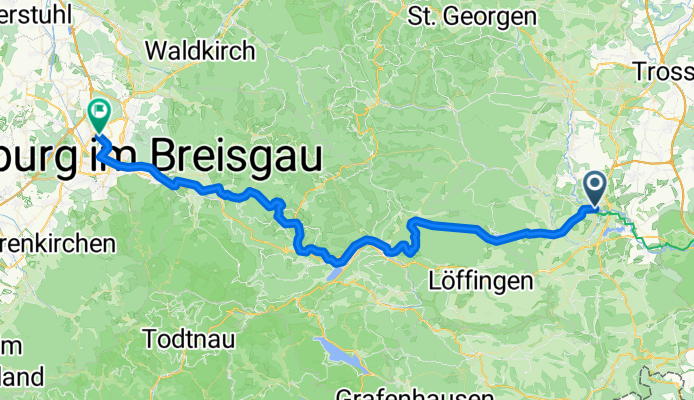
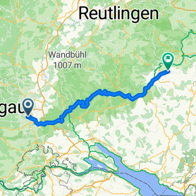
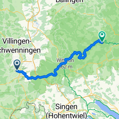
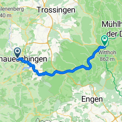
Karlstraße nach Hasenweg
A cycling route starting in Donaueschingen, Baden-Wurttemberg, Germany.
Overview
About this route
- 4 h 28 min
- Duration
- 73.4 km
- Distance
- 994 m
- Ascent
- 1,443 m
- Descent
- 16.4 km/h
- Avg. speed
- 1,066 m
- Max. altitude
Route quality
Waytypes & surfaces along the route
Waytypes
Quiet road
28.6 km
(39 %)
Path
21.3 km
(29 %)
Surfaces
Paved
56.5 km
(77 %)
Unpaved
11.7 km
(16 %)
Asphalt
56.5 km
(77 %)
Gravel
8.1 km
(11 %)
Continue with Bikemap
Use, edit, or download this cycling route
You would like to ride Karlstraße nach Hasenweg or customize it for your own trip? Here is what you can do with this Bikemap route:
Free features
- Save this route as favorite or in collections
- Copy & plan your own version of this route
- Sync your route with Garmin or Wahoo
Premium features
Free trial for 3 days, or one-time payment. More about Bikemap Premium.
- Navigate this route on iOS & Android
- Export a GPX / KML file of this route
- Create your custom printout (try it for free)
- Download this route for offline navigation
Discover more Premium features.
Get Bikemap PremiumFrom our community
Other popular routes starting in Donaueschingen
 Karlstraße nach Hasenweg
- Distance
- 73.4 km
- Ascent
- 994 m
- Descent
- 1,443 m
- Location
- Donaueschingen, Baden-Wurttemberg, Germany
 Donautour 1.Etappe
- Distance
- 99.3 km
- Ascent
- 311 m
- Descent
- 407 m
- Location
- Donaueschingen, Baden-Wurttemberg, Germany
 E2. 6.7.25 Donaueschingen nach Mühlheim
- Distance
- 53.3 km
- Ascent
- 169 m
- Descent
- 227 m
- Location
- Donaueschingen, Baden-Wurttemberg, Germany
 Donaueschingen - Hausen am Bussen
- Distance
- 134.8 km
- Ascent
- 1,587 m
- Descent
- 1,727 m
- Location
- Donaueschingen, Baden-Wurttemberg, Germany
 Le Danube - 1ere partie
- Distance
- 932.4 km
- Ascent
- 318 m
- Descent
- 768 m
- Location
- Donaueschingen, Baden-Wurttemberg, Germany
 Die Donaueschingen-Siofók-Hypothese
- Distance
- 1,220.5 km
- Ascent
- 115 m
- Descent
- 680 m
- Location
- Donaueschingen, Baden-Wurttemberg, Germany
 001. Donaueschingen - Neumühle
- Distance
- 74.9 km
- Ascent
- 964 m
- Descent
- 1,021 m
- Location
- Donaueschingen, Baden-Wurttemberg, Germany
 Donaueschingen - Tuttlingen
- Distance
- 36.8 km
- Ascent
- 188 m
- Descent
- 224 m
- Location
- Donaueschingen, Baden-Wurttemberg, Germany
Open it in the app