
D12 nach Plaça de Catalunya
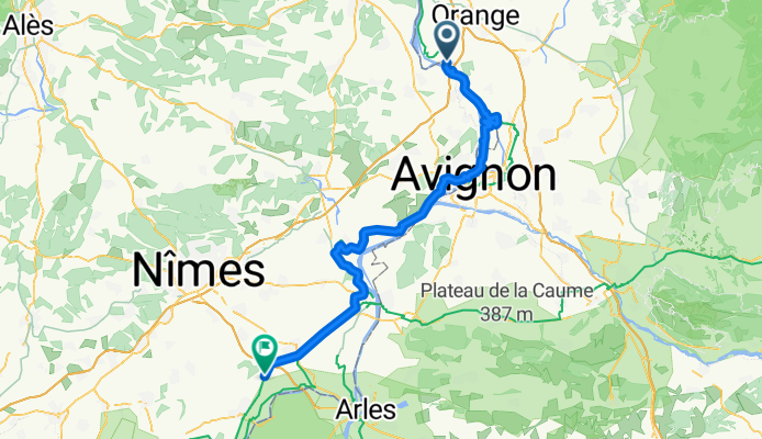
Montfaucon - Bellegarde
A cycling route starting in Montfaucon, Occitanie, France.OverviewAbout this route
- 4 h 34 min
- Duration
- 75.4 km
- Distance
- 250 m
- Ascent
- 273 m
- Descent
- 16.5 km/h
- Avg. speed
- 50 m
- Max. altitude
Simon Jostcreated this 7 months ago
D12 nach Plaça de Catalunya
12 stages
Waytypes
Quiet road
24.9 km33 %Cycleway
20.3 km27 %
Surfaces
Paved
49.7 km(66 %)Unpaved
10.5 km(14 %)Asphalt
49 km65 %Gravel
4.5 km6 %
Free features
- Save this route as favorite or in collections
- Copy & plan your own version of this route
- Sync your route with Garmin or Wahoo
Premium features
Free trial for 3 days, or one-time payment. More about Bikemap Premium.
- Navigate this route on iOS & Android
- Export a GPX / KML file of this route
- Create your custom printout (try it for free)
- Download this route for offline navigation
Discover more Premium features.
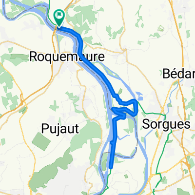
Get Bikemap Premium- De 38 Ancien Chemin de Bagnols, Montfaucon à 3 Rue du Salet, Saint-Victor-la-Coste
- 10.3 km
- 165 m
- 67 m
- Montfaucon, Occitanie, France
- 7- Roquemaure - Arles
- 58.8 km
- 120 m
- 142 m
- Montfaucon, Occitanie, France
- De 3QF9+8J à 3QF9+8J
- 42.1 km
- 242 m
- 326 m
- Montfaucon, Occitanie, France
- Montfaucon - Vitrolles
- 116.7 km
- 711 m
- 625 m
- Montfaucon, Occitanie, France
- De 3QF9+8J à 3QF9+8J
- 36.5 km
- 94 m
- 159 m
- Montfaucon, Occitanie, France
- Montfaucon - Aigues-Mortes
- 108.2 km
- 326 m
- 355 m
- Montfaucon, Occitanie, France
- nach Avignon
- 20.6 km
- 25 m
- 45 m
- Montfaucon, Occitanie, France


Open it in the app