
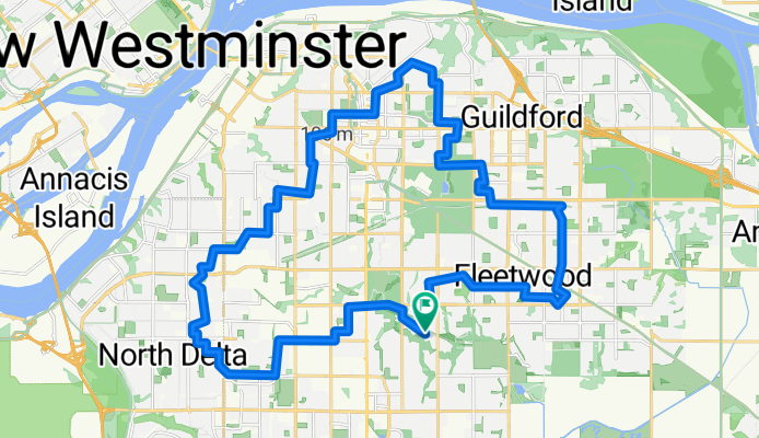
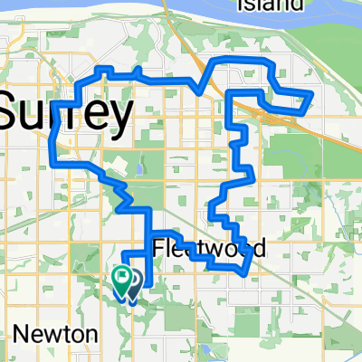
35 km North Delta Whalley Guildford Fleetwood
A cycling route starting in Surrey, British Columbia, Canada.
Overview
About this route
- 2 h 30 min
- Duration
- 36.2 km
- Distance
- 228 m
- Ascent
- 227 m
- Descent
- 14.5 km/h
- Avg. speed
- 126 m
- Max. altitude
Route quality
Waytypes & surfaces along the route
Waytypes
Quiet road
21.7 km
(60 %)
Cycleway
6.2 km
(17 %)
Surfaces
Paved
24.6 km
(68 %)
Asphalt
24.6 km
(68 %)
Undefined
11.6 km
(32 %)
Continue with Bikemap
Use, edit, or download this cycling route
You would like to ride 35 km North Delta Whalley Guildford Fleetwood or customize it for your own trip? Here is what you can do with this Bikemap route:
Free features
- Save this route as favorite or in collections
- Copy & plan your own version of this route
- Sync your route with Garmin or Wahoo
Premium features
Free trial for 3 days, or one-time payment. More about Bikemap Premium.
- Navigate this route on iOS & Android
- Export a GPX / KML file of this route
- Create your custom printout (try it for free)
- Download this route for offline navigation
Discover more Premium features.
Get Bikemap PremiumFrom our community
Other popular routes starting in Surrey
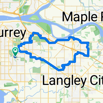
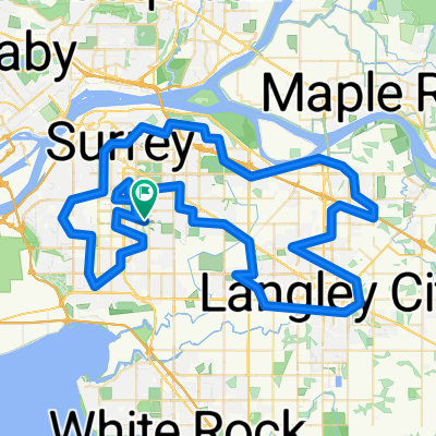 100 km Surrey Langley Loop
- Distance
- 103.3 km
- Ascent
- 590 m
- Descent
- 589 m
- Location
- Surrey, British Columbia, Canada
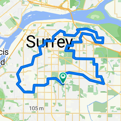
 45 km North Delta Whalley Fraser Heights Fleetwood
- Distance
- 46.4 km
- Ascent
- 280 m
- Descent
- 279 m
- Location
- Surrey, British Columbia, Canada
 153 St, Surrey to 95 Ave, Surrey
- Distance
- 56.1 km
- Ascent
- 334 m
- Descent
- 336 m
- Location
- Surrey, British Columbia, Canada
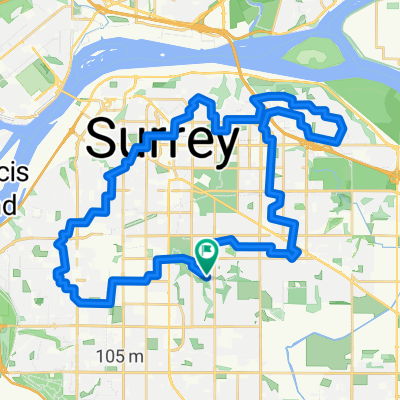
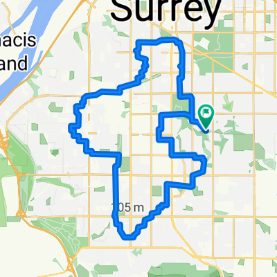
 33 km North Surrey Loop Lions Practice
- Distance
- 34.9 km
- Ascent
- 291 m
- Descent
- 291 m
- Location
- Surrey, British Columbia, Canada
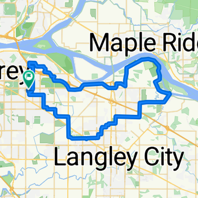
 50 km Tynehead Langley Clayton
- Distance
- 51.6 km
- Ascent
- 396 m
- Descent
- 395 m
- Location
- Surrey, British Columbia, Canada
 50 km North Delta Whalley Fraser Heights Fleetwood
- Distance
- 52.4 km
- Ascent
- 326 m
- Descent
- 325 m
- Location
- Surrey, British Columbia, Canada
 32 km Newton North Delta Loop
- Distance
- 32 km
- Ascent
- 193 m
- Descent
- 192 m
- Location
- Surrey, British Columbia, Canada
 70 km Tynehead Walnut Grove Clayton Langley Colverdale
- Distance
- 71.7 km
- Ascent
- 433 m
- Descent
- 432 m
- Location
- Surrey, British Columbia, Canada
Open it in the app