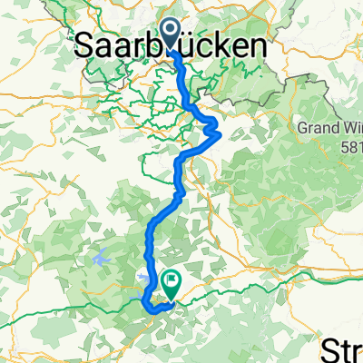
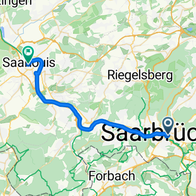
Alte Brücke naar Saaruferstraße
A cycling route starting in Saarbrücken, Saarland, Germany.
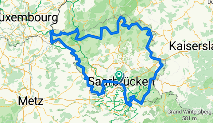
Overview
About this route
- 22 h 17 min
- Duration
- 352.7 km
- Distance
- 4,971 m
- Ascent
- 4,981 m
- Descent
- 15.8 km/h
- Avg. speed
- 580 m
- Max. altitude
Route quality
Waytypes & surfaces along the route
Waytypes
Track
127 km
(36 %)
Quiet road
74.1 km
(21 %)
Surfaces
Paved
271.6 km
(77 %)
Unpaved
52.9 km
(15 %)
Asphalt
208.1 km
(59 %)
Paved (undefined)
45.8 km
(13 %)
Continue with Bikemap
Use, edit, or download this cycling route
You would like to ride Alte Brücke naar Saaruferstraße or customize it for your own trip? Here is what you can do with this Bikemap route:
Free features
- Save this route as favorite or in collections
- Copy & plan your own version of this route
- Split it into stages to create a multi-day tour
- Sync your route with Garmin or Wahoo
Premium features
Free trial for 3 days, or one-time payment. More about Bikemap Premium.
- Navigate this route on iOS & Android
- Export a GPX / KML file of this route
- Create your custom printout (try it for free)
- Download this route for offline navigation
Discover more Premium features.
Get Bikemap PremiumFrom our community
Other popular routes starting in Saarbrücken
Bikepacking auf der VeloRoute SaarLorLux- Distance
- 465.8 km
- Ascent
- 4,760 m
- Descent
- 4,765 m
- Location
- Saarbrücken, Saarland, Germany
Feierabendtour- Distance
- 28.6 km
- Ascent
- 242 m
- Descent
- 251 m
- Location
- Saarbrücken, Saarland, Germany
Von Saarbrücken bis Großrosseln- Distance
- 27.7 km
- Ascent
- 307 m
- Descent
- 383 m
- Location
- Saarbrücken, Saarland, Germany
Coal Mining South of the Saar - 16 Tower Tour- Distance
- 61.8 km
- Ascent
- 582 m
- Descent
- 581 m
- Location
- Saarbrücken, Saarland, Germany
Saarbrücken - Einville-au-Jard- Distance
- 120 km
- Ascent
- 452 m
- Descent
- 433 m
- Location
- Saarbrücken, Saarland, Germany
RTF 16. Jumelage Moselle-Saar 2008 RV Blitz Saarbrücken 1897 e.V. 83 km- Distance
- 78.6 km
- Ascent
- 855 m
- Descent
- 900 m
- Location
- Saarbrücken, Saarland, Germany
Bike&Boulder- Distance
- 29.2 km
- Ascent
- 381 m
- Descent
- 381 m
- Location
- Saarbrücken, Saarland, Germany
SB nach Vaison la R. Chemin des Fontaines- Distance
- 759.3 km
- Ascent
- 5,618 m
- Descent
- 5,541 m
- Location
- Saarbrücken, Saarland, Germany
Open it in the app


