

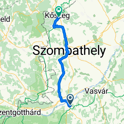
Negyvennyolcas utca, Körmend - Winzerstraße, Németlövő-Csejke
A cycling route starting in Körmend, Vas County, Hungary.
Overview
About this route
- 4 h 10 min
- Duration
- 35.1 km
- Distance
- 279 m
- Ascent
- 253 m
- Descent
- 8.4 km/h
- Avg. speed
- 309 m
- Max. altitude

Route quality
Waytypes & surfaces along the route
Waytypes
Road
11.6 km
(33 %)
Quiet road
10.9 km
(31 %)
Surfaces
Paved
22.8 km
(65 %)
Unpaved
1.8 km
(5 %)
Asphalt
22.8 km
(65 %)
Gravel
1.8 km
(5 %)
Undefined
10.5 km
(30 %)
Continue with Bikemap
Use, edit, or download this cycling route
You would like to ride Negyvennyolcas utca, Körmend - Winzerstraße, Németlövő-Csejke or customize it for your own trip? Here is what you can do with this Bikemap route:
Free features
- Save this route as favorite or in collections
- Copy & plan your own version of this route
- Sync your route with Garmin or Wahoo
Premium features
Free trial for 3 days, or one-time payment. More about Bikemap Premium.
- Navigate this route on iOS & Android
- Export a GPX / KML file of this route
- Create your custom printout (try it for free)
- Download this route for offline navigation
Discover more Premium features.
Get Bikemap PremiumFrom our community
Other popular routes starting in Körmend
 VHR 3
VHR 3- Distance
- 58.1 km
- Ascent
- 115 m
- Descent
- 115 m
- Location
- Körmend, Vas County, Hungary
 Etapa 050B (Halogy - Hartberg)
- Distance
- 152.3 km
- Ascent
- 1,338 m
- Descent
- 1,223 m
- Location
- Körmend, Vas County, Hungary
 Negyvennyolcas utca, Körmend - Winzerstraße, Németlövő-Csejke
- Distance
- 35.1 km
- Ascent
- 279 m
- Descent
- 253 m
- Location
- Körmend, Vas County, Hungary
 From Nádasd to Kőszeg
- Distance
- 61.3 km
- Ascent
- 283 m
- Descent
- 223 m
- Location
- Körmend, Vas County, Hungary
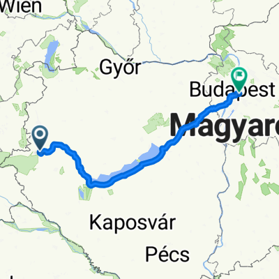
 Alpok - 2016 - 2
- Distance
- 4,193.2 km
- Ascent
- 14,989 m
- Descent
- 15,055 m
- Location
- Körmend, Vas County, Hungary
 2009 - Graz / Rax - Day 2
- Distance
- 69.5 km
- Ascent
- 171 m
- Descent
- 151 m
- Location
- Körmend, Vas County, Hungary
 Katafa to Budapest
- Distance
- 291.2 km
- Ascent
- 1,576 m
- Descent
- 1,659 m
- Location
- Körmend, Vas County, Hungary
 Petőfi Sándor út - Peteli-Hegyi út
- Distance
- 90.8 km
- Ascent
- 829 m
- Descent
- 860 m
- Location
- Körmend, Vas County, Hungary
Open it in the app