
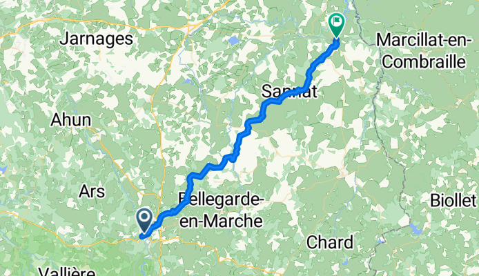
Aubusson to Evaux-les-Bains - Part on V87
A cycling route starting in Aubusson, Nouvelle-Aquitaine, France.
Overview
About this route
This was.really pleasant route, aside from the terrible short climb getting out of Aubusson. For anyone thinking about this ride, you should check whether you can pedal the wrong way on D942A since the one-way street heading northeast was a terrible short climb on a narrow road with cars. It was steep enough that we had to push the bikes the last half of the way up the climb. I'm not positive, but I think that you miss this terrible climb and descent if you go the wrong way on the one-way street of D942A headed southwest.
The rest of the ride was highly recommended.
- 5 h 5 min
- Duration
- 48.2 km
- Distance
- 587 m
- Ascent
- 692 m
- Descent
- 9.5 km/h
- Avg. speed
- 599 m
- Max. altitude

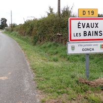
Route photos


Route quality
Waytypes & surfaces along the route
Waytypes
Road
36.6 km
(76 %)
Quiet road
2.4 km
(5 %)
Undefined
9.2 km
(19 %)
Surfaces
Paved
18.3 km
(38 %)
Asphalt
18.3 km
(38 %)
Undefined
29.9 km
(62 %)
Continue with Bikemap
Use, edit, or download this cycling route
You would like to ride Aubusson to Evaux-les-Bains - Part on V87 or customize it for your own trip? Here is what you can do with this Bikemap route:
Free features
- Save this route as favorite or in collections
- Copy & plan your own version of this route
- Sync your route with Garmin or Wahoo
Premium features
Free trial for 3 days, or one-time payment. More about Bikemap Premium.
- Navigate this route on iOS & Android
- Export a GPX / KML file of this route
- Create your custom printout (try it for free)
- Download this route for offline navigation
Discover more Premium features.
Get Bikemap PremiumFrom our community
Other popular routes starting in Aubusson
 Západní Francie 2016_1etapa
- Distance
- 46.7 km
- Ascent
- 493 m
- Descent
- 491 m
- Location
- Aubusson, Nouvelle-Aquitaine, France
 Etape 06 - Felletin à Bugeat - 55,3km 750D+
- Distance
- 55.8 km
- Ascent
- 582 m
- Descent
- 399 m
- Location
- Aubusson, Nouvelle-Aquitaine, France
 2009 Euro Tour -- Ride Day 4 —24 June 2009—23200 Aubusson to 63390 Saint Gervais d'Auvergne
- Distance
- 64.9 km
- Ascent
- 921 m
- Descent
- 638 m
- Location
- Aubusson, Nouvelle-Aquitaine, France
 etape 11 : aubusson - confolant
- Distance
- 59 km
- Ascent
- 945 m
- Descent
- 850 m
- Location
- Aubusson, Nouvelle-Aquitaine, France
 Aubusson to Evaux-les-Bains - Part on V87
- Distance
- 48.2 km
- Ascent
- 587 m
- Descent
- 692 m
- Location
- Aubusson, Nouvelle-Aquitaine, France
 Creuse 4
- Distance
- 49.3 km
- Ascent
- 440 m
- Descent
- 553 m
- Location
- Aubusson, Nouvelle-Aquitaine, France
 Aubusson - Mont Dore
- Distance
- 202 km
- Ascent
- 3,600 m
- Descent
- 2,871 m
- Location
- Aubusson, Nouvelle-Aquitaine, France
 Aubusson - Neuvic 80 km
- Distance
- 79.4 km
- Ascent
- 858 m
- Descent
- 671 m
- Location
- Aubusson, Nouvelle-Aquitaine, France
Open it in the app