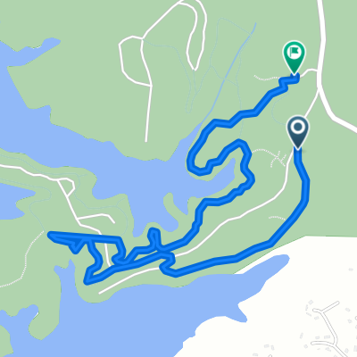


Iron Hill Trail @ Red Top Mountain
- 7.5 km
- 117 m
- 92 m
- Emerson, Georgia, United States
A cycling route starting in Emerson, Georgia, United States.
Overview
created this 3 months ago

Route quality
Cycleway
4.9 km
(65 %)
Pedestrian area
1.4 km
(18 %)
Paved
0.1 km
(1 %)
Unpaved
7 km
(93 %)
Gravel
6.5 km
(86 %)
Unpaved (undefined)
0.5 km
(7 %)
Continue with Bikemap
You would like to ride Iron Hill Trail @ Red Top Mountain or customize it for your own trip? Here is what you can do with this Bikemap route:
Free trial for 3 days, or one-time payment. More about Bikemap Premium.
Discover more Premium features.
Get Bikemap PremiumFrom our community
Open it in the app