
Hôtel de Ville nach Schönbeinstrasse 18-20
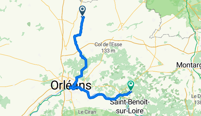
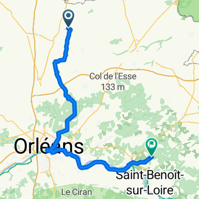
Outarville - Bouzy-la-Forêt
A cycling route starting in Outarville, Centre-Val de Loire, France.
Overview
About this route
- 5 h 17 min
- Duration
- 89.2 km
- Distance
- 199 m
- Ascent
- 206 m
- Descent
- 16.9 km/h
- Avg. speed
- 148 m
- Max. altitude

Part of
Route quality
Waytypes & surfaces along the route
Waytypes
Quiet road
64.3 km
(72 %)
Cycleway
8.9 km
(10 %)
Surfaces
Paved
56.2 km
(63 %)
Unpaved
1.8 km
(2 %)
Asphalt
52.7 km
(59 %)
Paved (undefined)
2.7 km
(3 %)
Continue with Bikemap
Use, edit, or download this cycling route
You would like to ride Outarville - Bouzy-la-Forêt or customize it for your own trip? Here is what you can do with this Bikemap route:
Free features
- Save this route as favorite or in collections
- Copy & plan your own version of this route
- Split it into stages to create a multi-day tour
- Sync your route with Garmin or Wahoo
Premium features
Free trial for 3 days, or one-time payment. More about Bikemap Premium.
- Navigate this route on iOS & Android
- Export a GPX / KML file of this route
- Create your custom printout (try it for free)
- Download this route for offline navigation
Discover more Premium features.
Get Bikemap PremiumFrom our community
Other popular routes starting in Outarville
 Itinéraire modéré en Attray
- Distance
- 9.5 km
- Ascent
- 411 m
- Descent
- 370 m
- Location
- Outarville, Centre-Val de Loire, France
 724 a
724 a- Distance
- 110.8 km
- Ascent
- 121 m
- Descent
- 173 m
- Location
- Outarville, Centre-Val de Loire, France
 Outarville - Bouzy-la-Forêt
- Distance
- 89.2 km
- Ascent
- 199 m
- Descent
- 206 m
- Location
- Outarville, Centre-Val de Loire, France
 carsac 724
- Distance
- 92.4 km
- Ascent
- 109 m
- Descent
- 146 m
- Location
- Outarville, Centre-Val de Loire, France
Open it in the app