
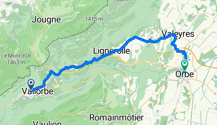
Route du Tunnel nach Rue des Terreaux
A cycling route starting in Vallorbe, Canton of Vaud, Switzerland.
Overview
About this route
- 1 h 9 min
- Duration
- 19.1 km
- Distance
- 245 m
- Ascent
- 563 m
- Descent
- 16.7 km/h
- Avg. speed
- 875 m
- Max. altitude
Route quality
Waytypes & surfaces along the route
Waytypes
Quiet road
10.5 km
(55 %)
Access road
4 km
(21 %)
Surfaces
Paved
9.2 km
(48 %)
Concrete
3.4 km
(18 %)
Paved (undefined)
2.9 km
(15 %)
Continue with Bikemap
Use, edit, or download this cycling route
You would like to ride Route du Tunnel nach Rue des Terreaux or customize it for your own trip? Here is what you can do with this Bikemap route:
Free features
- Save this route as favorite or in collections
- Copy & plan your own version of this route
- Sync your route with Garmin or Wahoo
Premium features
Free trial for 3 days, or one-time payment. More about Bikemap Premium.
- Navigate this route on iOS & Android
- Export a GPX / KML file of this route
- Create your custom printout (try it for free)
- Download this route for offline navigation
Discover more Premium features.
Get Bikemap PremiumFrom our community
Other popular routes starting in Vallorbe
 De Place du Château à Rue de l'Industrie
- Distance
- 36 km
- Ascent
- 545 m
- Descent
- 700 m
- Location
- Vallorbe, Canton of Vaud, Switzerland
 Itinéraire confortable en Ballaigues
- Distance
- 11.2 km
- Ascent
- 0 m
- Descent
- 0 m
- Location
- Vallorbe, Canton of Vaud, Switzerland
 Tour du Lac St. Point
- Distance
- 92.6 km
- Ascent
- 1,063 m
- Descent
- 1,077 m
- Location
- Vallorbe, Canton of Vaud, Switzerland
 Vallorbe - Le Locle
- Distance
- 81.7 km
- Ascent
- 405 m
- Descent
- 472 m
- Location
- Vallorbe, Canton of Vaud, Switzerland
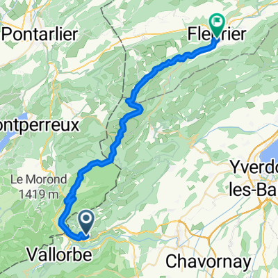 Ballaigue Fleurier
- Distance
- 35.3 km
- Ascent
- 687 m
- Descent
- 803 m
- Location
- Vallorbe, Canton of Vaud, Switzerland
 Rue de la Croix, Le Noirmont nach Place de Cornavin, Genf
- Distance
- 87.7 km
- Ascent
- 1,238 m
- Descent
- 1,598 m
- Location
- Vallorbe, Canton of Vaud, Switzerland
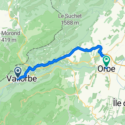 Route du Tunnel nach Rue des Terreaux
- Distance
- 19.1 km
- Ascent
- 245 m
- Descent
- 563 m
- Location
- Vallorbe, Canton of Vaud, Switzerland
 Etappe 5
- Distance
- 62.6 km
- Ascent
- 734 m
- Descent
- 1,080 m
- Location
- Vallorbe, Canton of Vaud, Switzerland
Open it in the app