

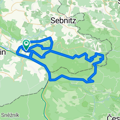
Zum Kaltenberg
A cycling route starting in Bad Schandau, Saxony, Germany.
Overview
About this route
Beautiful tour into Bohemia: First flat in the Elbe valley to Herrnskretschen (Hřensko), then steep to the plateau near Johnsdorf (Janov) and back down into the valley of Kamnitz (Kamenice) via Rosendorf (Růžová) and Kamnitzleiten (Kamenická Stráň) to the former Grundmühle (Dolský Mlýn). Through the valley of Dittersbach Biela, one reaches the beautiful little town of Dittersbach (Jetřichovice) with its noteworthy rock landscape. Following the country road to Schemmel (Všemily) and the left-turning bike path 21. The path is first quite rocky and steep through the forest, but then flatter over the meadow. Here one already has a nice view of the Kaltenberg. In Kunnersdorf, one initially keeps left, follows the road to the upper end of the village, keeps right here and after a forest passage arrives at the heavily trafficked road to Hasel (Líska). One turns left from the main road into the village and steeply climbs to the saddle at Kaltenberg. If desired, one can walk up the mountain with a historic tower; the view is well worth it. From here, stick to the blue hiking trail markers and reach Kreibitz (Chribska) by following the road on the last kilometer. Turning left goes down the village and at the next intersection, one follows the road to Daubitz (Doubice) and Khaa (Kyjov). From here, one rolls down the Khaatal (Kyjovske udoli) to the border crossing Hinterdaubitz (Zadni Doubice) / Niedermühle. Through Wettinplatz and Hollweg, one arrives back in the valley of the Kirnitzsch and continues along it to Bad Schandau.
- -:--
- Duration
- 84.1 km
- Distance
- 850 m
- Ascent
- 850 m
- Descent
- ---
- Avg. speed
- ---
- Max. altitude

Route quality
Waytypes & surfaces along the route
Waytypes
Track
31.9 km
(38 %)
Road
20.2 km
(24 %)
Surfaces
Paved
43.7 km
(52 %)
Unpaved
23.5 km
(28 %)
Asphalt
43.7 km
(52 %)
Gravel
16.8 km
(20 %)
Continue with Bikemap
Use, edit, or download this cycling route
You would like to ride Zum Kaltenberg or customize it for your own trip? Here is what you can do with this Bikemap route:
Free features
- Save this route as favorite or in collections
- Copy & plan your own version of this route
- Split it into stages to create a multi-day tour
- Sync your route with Garmin or Wahoo
Premium features
Free trial for 3 days, or one-time payment. More about Bikemap Premium.
- Navigate this route on iOS & Android
- Export a GPX / KML file of this route
- Create your custom printout (try it for free)
- Download this route for offline navigation
Discover more Premium features.
Get Bikemap PremiumFrom our community
Other popular routes starting in Bad Schandau
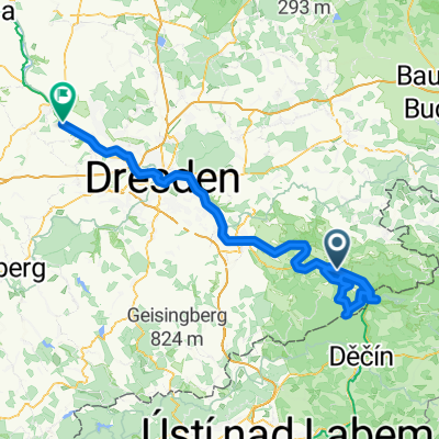
 2005 - Elberadweg Bad Schandau - Decin (CZ) - Leipzig
- Distance
- 304 km
- Ascent
- 797 m
- Descent
- 853 m
- Location
- Bad Schandau, Saxony, Germany
 Tetschen - Meißen
- Distance
- 123.9 km
- Ascent
- 1,632 m
- Descent
- 1,628 m
- Location
- Bad Schandau, Saxony, Germany
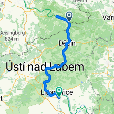 Tetschen - Štětí
- Distance
- 85.3 km
- Ascent
- 619 m
- Descent
- 593 m
- Location
- Bad Schandau, Saxony, Germany
 Elberadweg
- Distance
- 855.3 km
- Ascent
- 186 m
- Descent
- 327 m
- Location
- Bad Schandau, Saxony, Germany
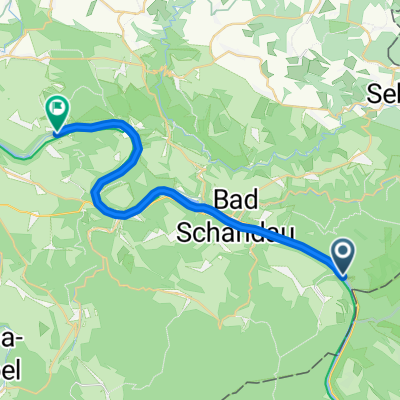
 Elbsandsteintour
- Distance
- 68.3 km
- Ascent
- 828 m
- Descent
- 828 m
- Location
- Bad Schandau, Saxony, Germany
 Zum Kaltenberg
- Distance
- 84.1 km
- Ascent
- 850 m
- Descent
- 850 m
- Location
- Bad Schandau, Saxony, Germany
 Elberadweg
- Distance
- 773.3 km
- Ascent
- 237 m
- Descent
- 394 m
- Location
- Bad Schandau, Saxony, Germany
 Von Schmilka bis Stadt Wehlen
- Distance
- 22.3 km
- Ascent
- 10 m
- Descent
- 17 m
- Location
- Bad Schandau, Saxony, Germany
Open it in the app