![Ph0]에서 경로북하면 247-3](https://media.bikemap.net/routes/17549199/staticmaps/in_847911c0-3848-4dd1-b060-ab13b95806de_694x400_bikemap-2021-3D-static.png)

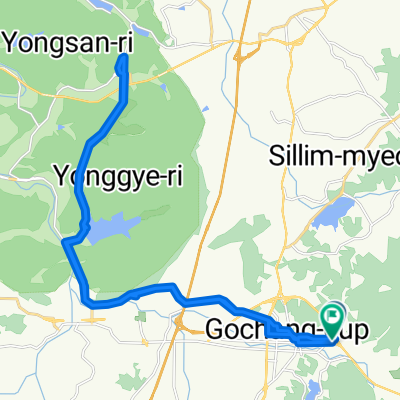
황룡면 698-5, 장성군 ~ 황룡면 698-5, 장성군
- 6.1 km
- 37 m
- 66 m
- Koch'ang, Jeollabuk-do, South Korea
A cycling route starting in Koch'ang, Jeollabuk-do, South Korea.
Overview
created this 3 months ago
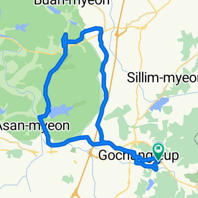
![Photo 1 of the Bikemap route "Ph0]에서 경로북하면 247-3"](https://media.bikemap.net/routes/17549199/gallery/thumbs/7707d6b4-84b5-441f-92da-6f5786c6f4cb.jpg.688x400_q80_crop.jpg "Photo 1 of the Bikemap route \"Ph0]에서 경로북하면 247-3\"")
![Photo 2 of the Bikemap route "Ph0]에서 경로북하면 247-3"](https://media.bikemap.net/routes/17549199/gallery/thumbs/16ce3b26-7f33-49b1-ba68-6ae7e6cee0e1.jpg.688x400_q80_crop.jpg "Photo 2 of the Bikemap route \"Ph0]에서 경로북하면 247-3\"")
![Photo 3 of the Bikemap route "Ph0]에서 경로북하면 247-3"](https://media.bikemap.net/routes/17549199/gallery/thumbs/0c29ecb3-d1bc-4ec9-bfbd-738cdfbe2a7c.jpg.208x208_q80_crop.jpg "Photo 3 of the Bikemap route \"Ph0]에서 경로북하면 247-3\"")
![Photo 4 of the Bikemap route "Ph0]에서 경로북하면 247-3"](https://media.bikemap.net/routes/17549199/gallery/thumbs/2b5708f3-b65b-4c24-a883-06c83ee32c09.jpg.208x208_q80_crop.jpg "Photo 4 of the Bikemap route \"Ph0]에서 경로북하면 247-3\"")
Continue with Bikemap
You would like to ride Ph0]에서 경로북하면 247-3 or customize it for your own trip? Here is what you can do with this Bikemap route:
Free trial for 3 days, or one-time payment. More about Bikemap Premium.
Discover more Premium features.
Get Bikemap PremiumFrom our community
Open it in the app

![Ph0]에서 경로장성읍 270-1](https://media.bikemap.net/routes/17535394/gallery/thumbs/b2359e2a-a696-48db-8c2f-5f5e842a29ac.jpg.208x208_q80_crop.jpg)


![Ph0]에서 경로북하면 247-3](https://media.bikemap.net/routes/17549199/gallery/thumbs/7707d6b4-84b5-441f-92da-6f5786c6f4cb.jpg.208x208_q80_crop.jpg)