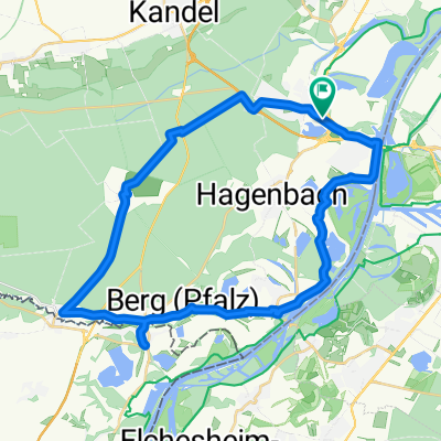
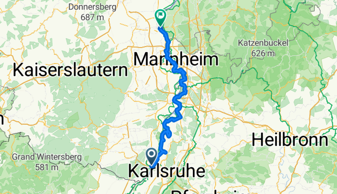
Wörth am Rhein - Worms
A cycling route starting in Wörth am Rhein, Rhineland-Palatinate, Germany.
Overview
About this route
- 6 h 40 min
- Duration
- 113.2 km
- Distance
- 0 m
- Ascent
- 15 m
- Descent
- 17 km/h
- Avg. speed
- 105 m
- Max. altitude
Route quality
Waytypes & surfaces along the route
Waytypes
Track
37.4 km
(33 %)
Path
26 km
(23 %)
Surfaces
Paved
75.8 km
(67 %)
Unpaved
20.4 km
(18 %)
Asphalt
67.9 km
(60 %)
Loose gravel
10.2 km
(9 %)
Continue with Bikemap
Use, edit, or download this cycling route
You would like to ride Wörth am Rhein - Worms or customize it for your own trip? Here is what you can do with this Bikemap route:
Free features
- Save this route as favorite or in collections
- Copy & plan your own version of this route
- Split it into stages to create a multi-day tour
- Sync your route with Garmin or Wahoo
Premium features
Free trial for 3 days, or one-time payment. More about Bikemap Premium.
- Navigate this route on iOS & Android
- Export a GPX / KML file of this route
- Create your custom printout (try it for free)
- Download this route for offline navigation
Discover more Premium features.
Get Bikemap PremiumFrom our community
Other popular routes starting in Wörth am Rhein
Wörth am Rhein - Kehl- Distance
- 77.1 km
- Ascent
- 206 m
- Descent
- 168 m
- Location
- Wörth am Rhein, Rhineland-Palatinate, Germany
44_Wörth – Lauterbourg (F) – Wörth- Distance
- 37.6 km
- Ascent
- 71 m
- Descent
- 71 m
- Location
- Wörth am Rhein, Rhineland-Palatinate, Germany
Hanns-Martin-Schleyer-Straße, Wörth am Rhein nach Route de l'Hôpital, Straßburg- Distance
- 84.1 km
- Ascent
- 231 m
- Descent
- 209 m
- Location
- Wörth am Rhein, Rhineland-Palatinate, Germany
Wörth am Rhein - Worms- Distance
- 113.2 km
- Ascent
- 0 m
- Descent
- 15 m
- Location
- Wörth am Rhein, Rhineland-Palatinate, Germany
Maximiliansau- Distance
- 58.1 km
- Ascent
- 186 m
- Descent
- 240 m
- Location
- Wörth am Rhein, Rhineland-Palatinate, Germany
Deutsch-Französische Maifahrt 2010 - RTF des RSC Wörth 1980 e.V. - 133 km Strecke- Distance
- 123.8 km
- Ascent
- 601 m
- Descent
- 601 m
- Location
- Wörth am Rhein, Rhineland-Palatinate, Germany
Deutsch-Französische Maifahrt 2010 - RTF des RSC Wörth 1980 e.V. - 164 km Strecke- Distance
- 150 km
- Ascent
- 650 m
- Descent
- 650 m
- Location
- Wörth am Rhein, Rhineland-Palatinate, Germany
Eisenbahnstraße, Wörth am Rhein nach Rue Jacques Twinger, Drusenheim- Distance
- 54.2 km
- Ascent
- 143 m
- Descent
- 126 m
- Location
- Wörth am Rhein, Rhineland-Palatinate, Germany
Open it in the app


