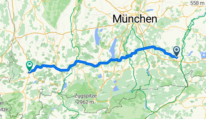
Overview
About this route
- 9 h 42 min
- Duration
- 170.3 km
- Distance
- 2,043 m
- Ascent
- 1,817 m
- Descent
- 17.6 km/h
- Avg. speed
- 942 m
- Max. altitude
Part of
From Salzburg to Constance
3 stages
Route quality
Waytypes & surfaces along the route
Waytypes
Quiet road
61.3 km
(36 %)
Road
59.6 km
(35 %)
Surfaces
Paved
154.9 km
(91 %)
Unpaved
8.5 km
(5 %)
Asphalt
146.4 km
(86 %)
Paved (undefined)
8.5 km
(5 %)
Continue with Bikemap
Use, edit, or download this cycling route
You would like to ride Bad Tölz - Isny or customize it for your own trip? Here is what you can do with this Bikemap route:
Free features
- Save this route as favorite or in collections
- Copy & plan your own version of this route
- Split it into stages to create a multi-day tour
- Sync your route with Garmin or Wahoo
Premium features
Free trial for 3 days, or one-time payment. More about Bikemap Premium.
- Navigate this route on iOS & Android
- Export a GPX / KML file of this route
- Create your custom printout (try it for free)
- Download this route for offline navigation
Discover more Premium features.
Get Bikemap PremiumFrom our community
Other popular routes starting in Kolbermoor
Rosenheim - Weßling 2013- Distance
- 90.7 km
- Ascent
- 329 m
- Descent
- 199 m
- Location
- Kolbermoor, Bavaria, Germany
Irschenberg1- Distance
- 15 km
- Ascent
- 260 m
- Descent
- 43 m
- Location
- Kolbermoor, Bavaria, Germany
Bad Tölz - Isny- Distance
- 170.3 km
- Ascent
- 2,043 m
- Descent
- 1,817 m
- Location
- Kolbermoor, Bavaria, Germany
Rosenheimer Runde 01- Distance
- 77 km
- Ascent
- 402 m
- Descent
- 402 m
- Location
- Kolbermoor, Bavaria, Germany
Simssee- Distance
- 48.9 km
- Ascent
- 338 m
- Descent
- 339 m
- Location
- Kolbermoor, Bavaria, Germany
11.09.25 Kolbermoor-Nußdorf- Distance
- 48.3 km
- Ascent
- 104 m
- Descent
- 105 m
- Location
- Kolbermoor, Bavaria, Germany
Unterkaltbrunner Straße 2, Rosenheim nach Rosengassenweg 17, Rosenheim- Distance
- 37.2 km
- Ascent
- 141 m
- Descent
- 187 m
- Location
- Kolbermoor, Bavaria, Germany
Samerberg- Distance
- 58.3 km
- Ascent
- 458 m
- Descent
- 459 m
- Location
- Kolbermoor, Bavaria, Germany
Open it in the app


