
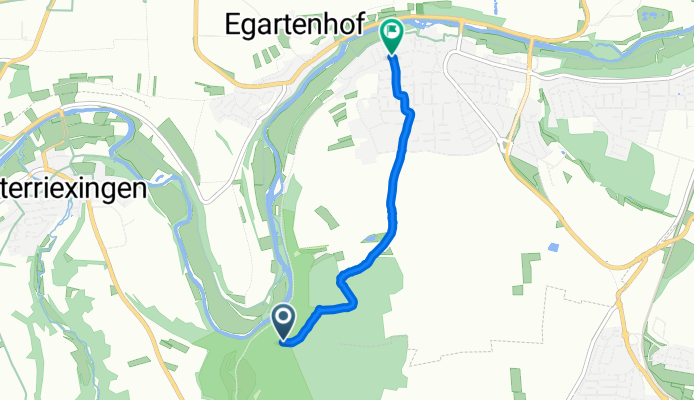
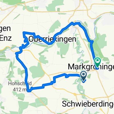
Bietigheim-Bissingen nach Schulstraße
A cycling route starting in Markgröningen, Baden-Wurttemberg, Germany.
Overview
About this route
- 55 min
- Duration
- 3.6 km
- Distance
- 67 m
- Ascent
- 167 m
- Descent
- 3.9 km/h
- Avg. speed
- 296 m
- Max. altitude
Route photos


Route quality
Waytypes & surfaces along the route
Waytypes
Track
1.8 km
(50 %)
Quiet road
1 km
(27 %)
Surfaces
Paved
1.5 km
(41 %)
Unpaved
1.5 km
(43 %)
Asphalt
1.5 km
(41 %)
Loose gravel
1 km
(27 %)
Continue with Bikemap
Use, edit, or download this cycling route
You would like to ride Bietigheim-Bissingen nach Schulstraße or customize it for your own trip? Here is what you can do with this Bikemap route:
Free features
- Save this route as favorite or in collections
- Copy & plan your own version of this route
- Sync your route with Garmin or Wahoo
Premium features
Free trial for 3 days, or one-time payment. More about Bikemap Premium.
- Navigate this route on iOS & Android
- Export a GPX / KML file of this route
- Create your custom printout (try it for free)
- Download this route for offline navigation
Discover more Premium features.
Get Bikemap PremiumFrom our community
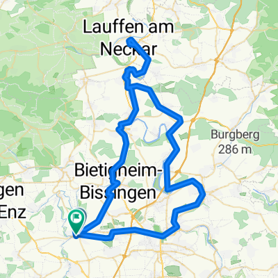
Other popular routes starting in Markgröningen
 lockere Feierabendrunde
- Distance
- 25.1 km
- Ascent
- 167 m
- Descent
- 216 m
- Location
- Markgröningen, Baden-Wurttemberg, Germany
 Mlg--Vaihingen-Sachsenheim-BiBi-Tamm-Mkg-47km
- Distance
- 47.4 km
- Ascent
- 392 m
- Descent
- 392 m
- Location
- Markgröningen, Baden-Wurttemberg, Germany
 Kunstholzen to Grabenstraße
- Distance
- 29.2 km
- Ascent
- 360 m
- Descent
- 394 m
- Location
- Markgröningen, Baden-Wurttemberg, Germany
 Markgröningen to Markgröningen
- Distance
- 76.4 km
- Ascent
- 642 m
- Descent
- 656 m
- Location
- Markgröningen, Baden-Wurttemberg, Germany
 Münchingen-Ditzingen--Vaihingen-Sachsenheim-Untermberg-Bissingen-Tamm-Mkg-55km
- Distance
- 55.3 km
- Ascent
- 460 m
- Descent
- 460 m
- Location
- Markgröningen, Baden-Wurttemberg, Germany
 Neckartal - Max-Eyth-See
- Distance
- 48.2 km
- Ascent
- 229 m
- Descent
- 229 m
- Location
- Markgröningen, Baden-Wurttemberg, Germany
 Max-Eyth-See kurz
- Distance
- 42.6 km
- Ascent
- 246 m
- Descent
- 245 m
- Location
- Markgröningen, Baden-Wurttemberg, Germany
 Enzweihingen-Schöckingen-Münchingen 34 km km
- Distance
- 33.9 km
- Ascent
- 396 m
- Descent
- 398 m
- Location
- Markgröningen, Baden-Wurttemberg, Germany
Open it in the app