
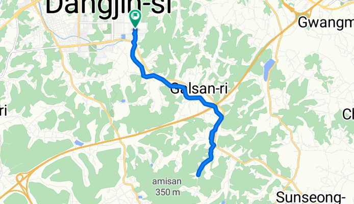
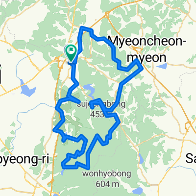
보통 경로
A cycling route starting in Tangjin, Chungcheongnam-do, South Korea.
Overview
About this route
- 53 min
- Duration
- 12.8 km
- Distance
- 90 m
- Ascent
- 118 m
- Descent
- 14.4 km/h
- Avg. speed
- 95 m
- Max. altitude

Continue with Bikemap
Use, edit, or download this cycling route
You would like to ride 보통 경로 or customize it for your own trip? Here is what you can do with this Bikemap route:
Free features
- Save this route as favorite or in collections
- Copy & plan your own version of this route
- Sync your route with Garmin or Wahoo
Premium features
Free trial for 3 days, or one-time payment. More about Bikemap Premium.
- Navigate this route on iOS & Android
- Export a GPX / KML file of this route
- Create your custom printout (try it for free)
- Download this route for offline navigation
Discover more Premium features.
Get Bikemap PremiumFrom our community
Other popular routes starting in Tangjin
 송산면 410-49 ~ 송산면 410-49
- Distance
- 32.3 km
- Ascent
- 94 m
- Descent
- 120 m
- Location
- Tangjin, Chungcheongnam-do, South Korea
 송악읍 56-50, 당진시 ~ 송악읍 481, 당진시
- Distance
- 40.6 km
- Ascent
- 186 m
- Descent
- 206 m
- Location
- Tangjin, Chungcheongnam-do, South Korea
 읍내동 1642, 당진시 ~ 읍내동 1540, 당진시
- Distance
- 53.4 km
- Ascent
- 223 m
- Descent
- 228 m
- Location
- Tangjin, Chungcheongnam-do, South Korea
 신평면 806-1 ~ 신평면 807-2
- Distance
- 7.2 km
- Ascent
- 10 m
- Descent
- 36 m
- Location
- Tangjin, Chungcheongnam-do, South Korea
 송산면 410-49 ~ 송산면 410-49
- Distance
- 32.3 km
- Ascent
- 204 m
- Descent
- 260 m
- Location
- Tangjin, Chungcheongnam-do, South Korea
![수청동Ph0]으로 라우팅](https://media.bikemap.net/routes/17589073/staticmaps/in_b32044b0-93c1-4c31-af1c-8e8f5758fc8b_400x400_bikemap-2021-3D-static.png) 수청동Ph0]으로 라우팅
수청동Ph0]으로 라우팅- Distance
- 14.4 km
- Ascent
- 132 m
- Descent
- 145 m
- Location
- Tangjin, Chungcheongnam-do, South Korea
 수청동 859, 당진시 ~ 수청동 954-6, 당진시
- Distance
- 3.5 km
- Ascent
- 200 m
- Descent
- 220 m
- Location
- Tangjin, Chungcheongnam-do, South Korea
 개심사 예정
- Distance
- 60.8 km
- Ascent
- 1,564 m
- Descent
- 1,575 m
- Location
- Tangjin, Chungcheongnam-do, South Korea
Open it in the app