
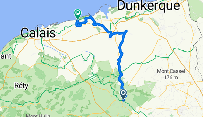
Au Fil de l’Ô - Étape 2 Saint Omer - Oye Plage
A cycling route starting in Saint-Omer, Hauts-de-France, France.
Overview
About this route
- 5 h 47 min
- Duration
- 61.3 km
- Distance
- 122 m
- Ascent
- 123 m
- Descent
- 10.6 km/h
- Avg. speed
- 73 m
- Max. altitude

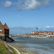
Route photos


Route quality
Waytypes & surfaces along the route
Waytypes
Quiet road
23.3 km
(38 %)
Road
14.7 km
(24 %)
Surfaces
Paved
52.7 km
(86 %)
Unpaved
1.8 km
(3 %)
Asphalt
43.5 km
(71 %)
Paved (undefined)
6.7 km
(11 %)
Continue with Bikemap
Use, edit, or download this cycling route
You would like to ride Au Fil de l’Ô - Étape 2 Saint Omer - Oye Plage or customize it for your own trip? Here is what you can do with this Bikemap route:
Free features
- Save this route as favorite or in collections
- Copy & plan your own version of this route
- Sync your route with Garmin or Wahoo
Premium features
Free trial for 3 days, or one-time payment. More about Bikemap Premium.
- Navigate this route on iOS & Android
- Export a GPX / KML file of this route
- Create your custom printout (try it for free)
- Download this route for offline navigation
Discover more Premium features.
Get Bikemap PremiumFrom our community
Other popular routes starting in Saint-Omer
 RING OF FIRE 2017 FRANCE 2
- Distance
- 33.6 km
- Ascent
- 90 m
- Descent
- 82 m
- Location
- Saint-Omer, Hauts-de-France, France
 Entre Audomarois et Flandre
- Distance
- 55.4 km
- Ascent
- 143 m
- Descent
- 143 m
- Location
- Saint-Omer, Hauts-de-France, France
 AR Aire retour par Roquetoire
- Distance
- 48.4 km
- Ascent
- 136 m
- Descent
- 136 m
- Location
- Saint-Omer, Hauts-de-France, France
 Tour de France
- Distance
- 59.6 km
- Ascent
- 45 m
- Descent
- 44 m
- Location
- Saint-Omer, Hauts-de-France, France
 St Omer - Boulogne SM
- Distance
- 71.4 km
- Ascent
- 371 m
- Descent
- 356 m
- Location
- Saint-Omer, Hauts-de-France, France
 audomarois
- Distance
- 32.4 km
- Ascent
- 69 m
- Descent
- 68 m
- Location
- Saint-Omer, Hauts-de-France, France
 Marais de l'audomarois
- Distance
- 32.9 km
- Ascent
- 42 m
- Descent
- 41 m
- Location
- Saint-Omer, Hauts-de-France, France
 Au Fil de l’Ô - Étape 2 Saint Omer - Oye Plage
- Distance
- 61.3 km
- Ascent
- 122 m
- Descent
- 123 m
- Location
- Saint-Omer, Hauts-de-France, France
Open it in the app