

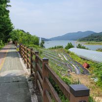
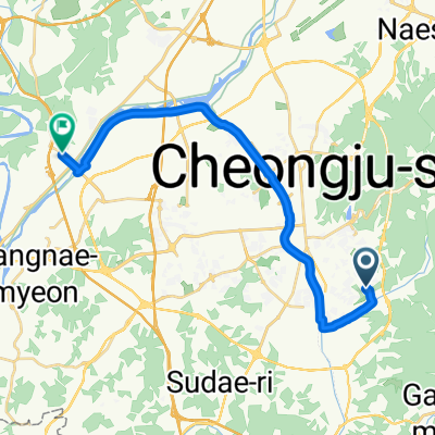
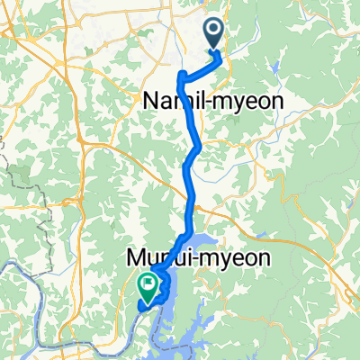
보통 경로
A cycling route starting in Cheongju-si, North Chungcheong, South Korea.
Overview
About this route
- 1 h 19 min
- Duration
- 23.4 km
- Distance
- 201 m
- Ascent
- 270 m
- Descent
- 17.7 km/h
- Avg. speed
- 125 m
- Max. altitude

Continue with Bikemap
Use, edit, or download this cycling route
You would like to ride 보통 경로 or customize it for your own trip? Here is what you can do with this Bikemap route:
Free features
- Save this route as favorite or in collections
- Copy & plan your own version of this route
- Sync your route with Garmin or Wahoo
Premium features
Free trial for 3 days, or one-time payment. More about Bikemap Premium.
- Navigate this route on iOS & Android
- Export a GPX / KML file of this route
- Create your custom printout (try it for free)
- Download this route for offline navigation
Discover more Premium features.
Get Bikemap PremiumFrom our community
Other popular routes starting in Cheongju-si
 분평동 3, 청주시 to 용암동 770−41, 청주시
- Distance
- 68.5 km
- Ascent
- 957 m
- Descent
- 947 m
- Location
- Cheongju-si, North Chungcheong, South Korea
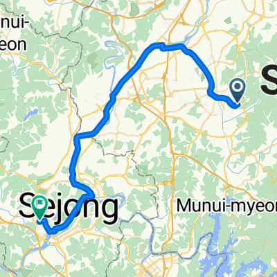 청주집에서 세종
- Distance
- 49.9 km
- Ascent
- 226 m
- Descent
- 291 m
- Location
- Cheongju-si, North Chungcheong, South Korea
![용암동 169번지Ph0]으로 라우팅](https://media.bikemap.net/routes/17677785/staticmaps/in_530e89f8-1499-4cf8-be8c-2f058ef1bf05_400x400_bikemap-2021-3D-static.png) 용암동 169번지Ph0]으로 라우팅
용암동 169번지Ph0]으로 라우팅- Distance
- 17.4 km
- Ascent
- 83 m
- Descent
- 97 m
- Location
- Cheongju-si, North Chungcheong, South Korea
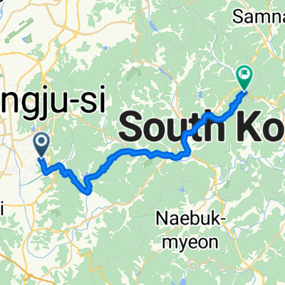
 용암동 ~ 옥산면 739-11
- Distance
- 22.8 km
- Ascent
- 54 m
- Descent
- 133 m
- Location
- Cheongju-si, North Chungcheong, South Korea
 용암동, 청주시에서 구방2길, 청주시까지
- Distance
- 29.8 km
- Ascent
- 878 m
- Descent
- 785 m
- Location
- Cheongju-si, North Chungcheong, South Korea
 보통 경로
보통 경로- Distance
- 23.4 km
- Ascent
- 201 m
- Descent
- 270 m
- Location
- Cheongju-si, North Chungcheong, South Korea
 용암동, 청주시에서 고은리, 청주시까지
- Distance
- 8.4 km
- Ascent
- 66 m
- Descent
- 110 m
- Location
- Cheongju-si, North Chungcheong, South Korea
 도원리, 청주시에서 충청대로, 청주시까지
- Distance
- 12.1 km
- Ascent
- 98 m
- Descent
- 99 m
- Location
- Cheongju-si, North Chungcheong, South Korea
Open it in the app