

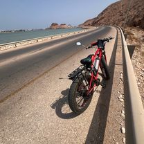
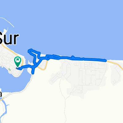
ولاية صور to ولاية صور
A cycling route starting in Sur, Ash Sharqiyah South Governorate, Oman.
Overview
About this route
- 1 h 17 min
- Duration
- 11.1 km
- Distance
- 32 m
- Ascent
- 29 m
- Descent
- 8.7 km/h
- Avg. speed
- 12 m
- Max. altitude

Route quality
Waytypes & surfaces along the route
Waytypes
Quiet road
3.8 km
(34 %)
Access road
1.1 km
(10 %)
Surfaces
Paved
5.2 km
(47 %)
Asphalt
5.2 km
(47 %)
Undefined
5.9 km
(53 %)
Continue with Bikemap
Use, edit, or download this cycling route
You would like to ride ولاية صور to ولاية صور or customize it for your own trip? Here is what you can do with this Bikemap route:
Free features
- Save this route as favorite or in collections
- Copy & plan your own version of this route
- Sync your route with Garmin or Wahoo
Premium features
Free trial for 3 days, or one-time payment. More about Bikemap Premium.
- Navigate this route on iOS & Android
- Export a GPX / KML file of this route
- Create your custom printout (try it for free)
- Download this route for offline navigation
Discover more Premium features.
Get Bikemap PremiumFrom our community
Other popular routes starting in Sur
 ولاية صور to ولاية صور
- Distance
- 13.2 km
- Ascent
- 60 m
- Descent
- 75 m
- Location
- Sur, Ash Sharqiyah South Governorate, Oman
 ولاية صور to ولاية صور
- Distance
- 11.1 km
- Ascent
- 32 m
- Descent
- 29 m
- Location
- Sur, Ash Sharqiyah South Governorate, Oman
 Oman_03
- Distance
- 130.2 km
- Ascent
- 1,016 m
- Descent
- 316 m
- Location
- Sur, Ash Sharqiyah South Governorate, Oman
 Tour of Oman - Etappe 2
- Distance
- 139.5 km
- Ascent
- 538 m
- Descent
- 438 m
- Location
- Sur, Ash Sharqiyah South Governorate, Oman
 Restful route in Sur
- Distance
- 14.2 km
- Ascent
- 3 m
- Descent
- 6 m
- Location
- Sur, Ash Sharqiyah South Governorate, Oman
 Steady ride in Sur
- Distance
- 17.2 km
- Ascent
- 33 m
- Descent
- 54 m
- Location
- Sur, Ash Sharqiyah South Governorate, Oman
 Al ‘Āmrāt - Ṣūr
- Distance
- 198 km
- Ascent
- 812 m
- Descent
- 710 m
- Location
- Sur, Ash Sharqiyah South Governorate, Oman
 Moderate route in Sur
- Distance
- 30.9 km
- Ascent
- 36 m
- Descent
- 58 m
- Location
- Sur, Ash Sharqiyah South Governorate, Oman
Open it in the app