MTB Runde (43km)
- 42 km
- 360 m
- 360 m
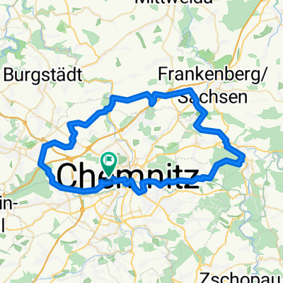
- Chemnitz, Saxony, Germany
A cycling route starting in Chemnitz, Saxony, Germany.
Overview
You should ride this route on the weekend because almost everything takes place on the road. At first, up to Hohenstein, you can roll easily. From Hohenstein towards Langenberg, there's a tough climb, and over the Chemnitz valley towards the end, you can enjoy a nice descent. There are several places to stop along the route. Forsthaus Garnsdorf is nearly ideal since it's also pleasant to sit outside.
The elevation gain is about 540 meters, not as shown in the overview.created this 13 years ago
Route quality
Quiet road
12.4 km
19 %
Road
7.2 km
11 %
Paved
57.9 km
(89 %)
Unpaved
1.3 km
(2 %)
Asphalt
54.7 km
84 %
Concrete
2.6 km
4 %
Continue with Bikemap
You would like to ride Chemnitz Nordschleife or customize it for your own trip? Here is what you can do with this Bikemap route:
Free trial for 3 days, or one-time payment. More about Bikemap Premium.
Discover more Premium features.
Get Bikemap PremiumFrom our community
Open it in the app