

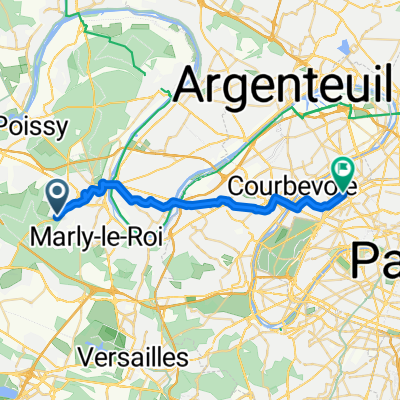
Fourqueux - SAP route
A cycling route starting in Mareil-Marly, Île-de-France Region, France.
Overview
About this route
- 1 h 17 min
- Duration
- 24.8 km
- Distance
- 202 m
- Ascent
- 305 m
- Descent
- 19.3 km/h
- Avg. speed
- 144 m
- Max. altitude
Route quality
Waytypes & surfaces along the route
Waytypes
Cycleway
8.4 km
(34 %)
Quiet road
6.9 km
(28 %)
Surfaces
Paved
18.8 km
(76 %)
Asphalt
18.3 km
(74 %)
Concrete
0.5 km
(2 %)
Undefined
5.9 km
(24 %)
Continue with Bikemap
Use, edit, or download this cycling route
You would like to ride Fourqueux - SAP route or customize it for your own trip? Here is what you can do with this Bikemap route:
Free features
- Save this route as favorite or in collections
- Copy & plan your own version of this route
- Sync your route with Garmin or Wahoo
Premium features
Free trial for 3 days, or one-time payment. More about Bikemap Premium.
- Navigate this route on iOS & Android
- Export a GPX / KML file of this route
- Create your custom printout (try it for free)
- Download this route for offline navigation
Discover more Premium features.
Get Bikemap PremiumFrom our community
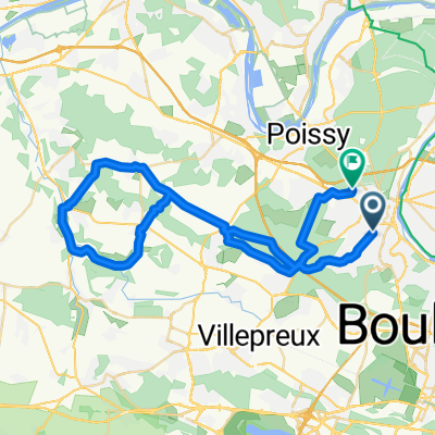
Other popular routes starting in Mareil-Marly
 Fourqueux - SAP route
- Distance
- 24.8 km
- Ascent
- 202 m
- Descent
- 305 m
- Location
- Mareil-Marly, Île-de-France Region, France
 Easy Sunday ride
- Distance
- 24.5 km
- Ascent
- 167 m
- Descent
- 154 m
- Location
- Mareil-Marly, Île-de-France Region, France
 Fourqueux - taff
- Distance
- 26.6 km
- Ascent
- 227 m
- Descent
- 330 m
- Location
- Mareil-Marly, Île-de-France Region, France

2713®
Mareil-Marly Cycling- Distance
- 36.1 km
- Ascent
- 469 m
- Descent
- 465 m
- Location
- Mareil-Marly, Île-de-France Region, France
 discovering route to work
- Distance
- 23.9 km
- Ascent
- 104 m
- Descent
- 114 m
- Location
- Mareil-Marly, Île-de-France Region, France
 Frqx-SAP-Direct
- Distance
- 21.7 km
- Ascent
- 202 m
- Descent
- 305 m
- Location
- Mareil-Marly, Île-de-France Region, France
 Forest International School to Saint Nom la Breteche train station easy mountain bike road
- Distance
- 4.7 km
- Ascent
- 48 m
- Descent
- 81 m
- Location
- Mareil-Marly, Île-de-France Region, France
 54 Route de l'Étang-la-Ville, Mareil-Marly to 51 Avenue Carnot, Saint-Germain-en-Laye
- Distance
- 47.5 km
- Ascent
- 445 m
- Descent
- 407 m
- Location
- Mareil-Marly, Île-de-France Region, France
Open it in the app