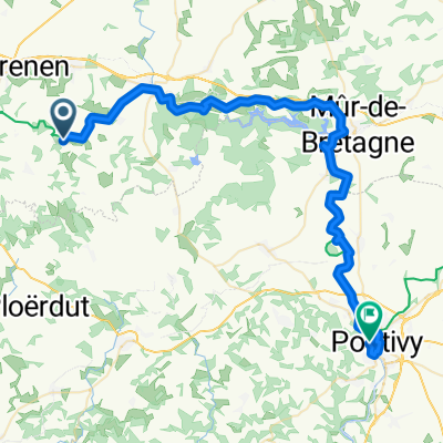
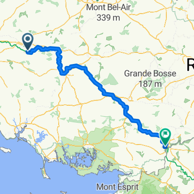
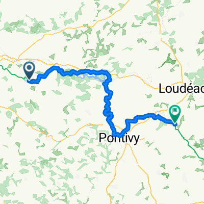
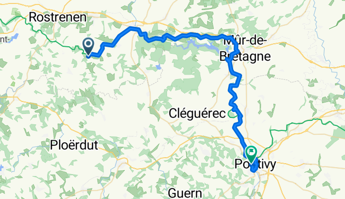
Carhaix-Plouguer - Gouarec
A cycling route starting in Plouguernével, Brittany Region, France.
Overview
About this route
- 3 h 31 min
 - Duration
 - 50.4 km
 - Distance
 - 372 m
 - Ascent
 - 439 m
 - Descent
 - 14.3 km/h
 - Avg. speed
 - 203 m
 - Max. altitude
 
Route quality
Waytypes & surfaces along the route
Waytypes
Path
42.3 km
(84 %)
Quiet road
6 km
(12 %)
Surfaces
Paved
3 km
(6 %)
Unpaved
39.3 km
(78 %)
Gravel
39.3 km
(78 %)
Asphalt
3 km
(6 %)
Undefined
8.1 km
(16 %)
Continue with Bikemap
Use, edit, or download this cycling route
You would like to ride Carhaix-Plouguer - Gouarec or customize it for your own trip? Here is what you can do with this Bikemap route:
Free features
- Save this route as favorite or in collections
 - Copy & plan your own version of this route
 - Sync your route with Garmin or Wahoo
 
Premium features
Free trial for 3 days, or one-time payment. More about Bikemap Premium.
- Navigate this route on iOS & Android
 - Export a GPX / KML file of this route
 - Create your custom printout (try it for free)
 - Download this route for offline navigation
 
Discover more Premium features.
Get Bikemap PremiumFrom our community
Other popular routes starting in Plouguernével
Plouguernével - Neulliac- Distance
 - 42.4 km
 - Ascent
 - 345 m
 - Descent
 - 392 m
 - Location
 - Plouguernével, Brittany Region, France
 
4.Plouguernével-Rostrenen- Distance
 - 121.2 km
 - Ascent
 - 610 m
 - Descent
 - 585 m
 - Location
 - Plouguernével, Brittany Region, France
 
Plouguernével - Redon- Distance
 - 159.8 km
 - Ascent
 - 898 m
 - Descent
 - 1,046 m
 - Location
 - Plouguernével, Brittany Region, France
 
gouarec- Distance
 - 6.6 km
 - Ascent
 - 17 m
 - Descent
 - 77 m
 - Location
 - Plouguernével, Brittany Region, France
 
De 6 Kergus, Plouguernével à 1 Route de Plounévez, Gouarec- Distance
 - 12.1 km
 - Ascent
 - 680 m
 - Descent
 - 764 m
 - Location
 - Plouguernével, Brittany Region, France
 
Carhaix-Plouguer - Gouarec- Distance
 - 50.4 km
 - Ascent
 - 372 m
 - Descent
 - 439 m
 - Location
 - Plouguernével, Brittany Region, France
 
4.Plouguernével – Rostrenen (7 giri circuito finale) km 171,8- Distance
 - 120.2 km
 - Ascent
 - 769 m
 - Descent
 - 766 m
 - Location
 - Plouguernével, Brittany Region, France
 
Sommerferien- Distance
 - 344.4 km
 - Ascent
 - 1,037 m
 - Descent
 - 1,030 m
 - Location
 - Plouguernével, Brittany Region, France
 
Open it in the app


