![임은동Ph0]으로 라우팅](/_next/static/media/contour-lines-light-small.cafd5e5d.avif)
![임은동Ph0]으로 라우팅](https://media.bikemap.net/routes/17567071/staticmaps/in_38348ae4-53d2-41bc-b0aa-95c1231bf2d0_694x400_bikemap-2021-3D-static.png)
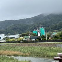
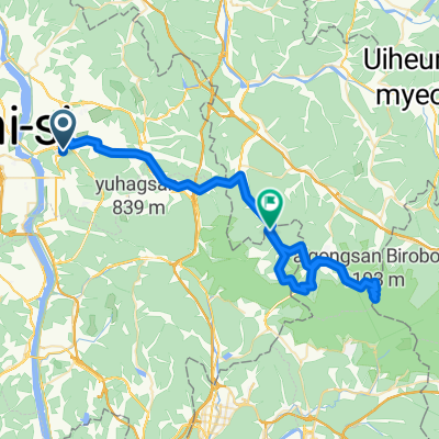
임은동Ph0]으로 라우팅
A cycling route starting in Gumi, Gyeongsangbuk-do, South Korea.
Overview
About this route
- 1 h 45 min
- Duration
- 21.6 km
- Distance
- 145 m
- Ascent
- 166 m
- Descent
- 12.4 km/h
- Avg. speed
- 65 m
- Max. altitude
Continue with Bikemap
Use, edit, or download this cycling route
You would like to ride 임은동Ph0]으로 라우팅 or customize it for your own trip? Here is what you can do with this Bikemap route:
Free features
- Save this route as favorite or in collections
- Copy & plan your own version of this route
- Sync your route with Garmin or Wahoo
Premium features
Free trial for 3 days, or one-time payment. More about Bikemap Premium.
- Navigate this route on iOS & Android
- Export a GPX / KML file of this route
- Create your custom printout (try it for free)
- Download this route for offline navigation
Discover more Premium features.
Get Bikemap PremiumFrom our community
Other popular routes starting in Gumi
 신비로, 구미시에서 칠곡군까지
- Distance
- 17.5 km
- Ascent
- 56 m
- Descent
- 80 m
- Location
- Gumi, Gyeongsangbuk-do, South Korea
 韓国縦走サイクリング3日目(亀尾→安東)
- Distance
- 148.7 km
- Ascent
- 325 m
- Descent
- 265 m
- Location
- Gumi, Gyeongsangbuk-do, South Korea
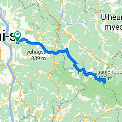
 Seokjeog-eup 153-12, Chilgok-gun to Seokjeog-eup 2-2, Chilgok-gun
- Distance
- 8.5 km
- Ascent
- 491 m
- Descent
- 60 m
- Location
- Gumi, Gyeongsangbuk-do, South Korea
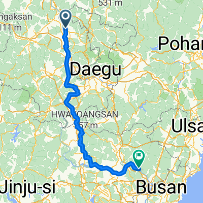 구미시 - 양산
- Distance
- 173.7 km
- Ascent
- 1,385 m
- Descent
- 1,413 m
- Location
- Gumi, Gyeongsangbuk-do, South Korea
 구포동-- 팔공 하늘공원
- Distance
- 79.2 km
- Ascent
- 1,502 m
- Descent
- 1,534 m
- Location
- Gumi, Gyeongsangbuk-do, South Korea
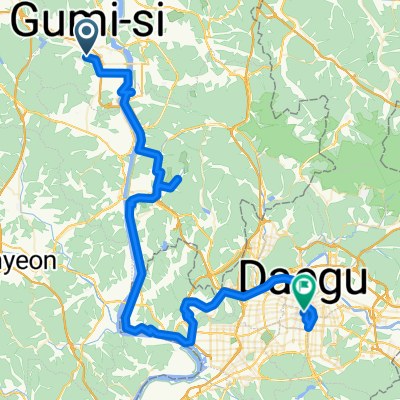
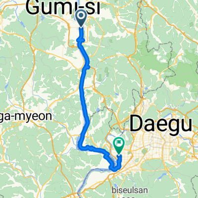 Gumi to Daegu
- Distance
- 51.2 km
- Ascent
- 221 m
- Descent
- 234 m
- Location
- Gumi, Gyeongsangbuk-do, South Korea
 구포동 -- 팔공산통신대
- Distance
- 64.4 km
- Ascent
- 1,694 m
- Descent
- 1,585 m
- Location
- Gumi, Gyeongsangbuk-do, South Korea
 Jour 5 - Gumi à Daegu
- Distance
- 84.4 km
- Ascent
- 547 m
- Descent
- 559 m
- Location
- Gumi, Gyeongsangbuk-do, South Korea
Open it in the app