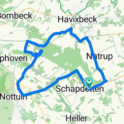
Nottuln Parklandschaft am Südhang
- 32.2 km
- 160 m
- 161 m
- Nottuln, North Rhine-Westphalia, Germany
A cycling route starting in Nottuln, North Rhine-Westphalia, Germany.
Overview
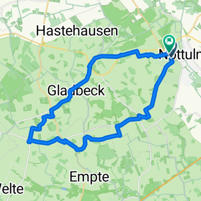
Embark on an exciting 20.6 km cycling adventure that offers a delightful mix of smooth and adventurous paths. The journey begins with a serene ride on asphalt for 47.9% of the distance, providing a comfortable and steady pace. As you pedal, you'll encounter a variety of surfaces, including a 26.4% share of trails that add an element of exploration and challenge. The route features a blend of paved and unpaved sections, with 45.6% of the ride on well-maintained paths. This diverse terrain keeps the experience fresh and engaging. Throughout the journey, you'll ascend a gentle 85 meters, followed by a descent of 85 meters, maintaining a balanced elevation profile. The highest point you'll reach is 117 meters, offering a rewarding view and a sense of accomplishment. With 44.4% of the route on the regional
AI generated
created this 5 months ago
Route quality
Quiet road
10.1 km
49 %
Path
5 km
24 %
Paved
18.2 km
(88 %)
Unpaved
1 km
(5 %)
Asphalt
18.2 km
88 %
Ground
1 km
5 %
Undefined
1.4 km
7 %
Continue with Bikemap
You would like to ride Am Hang, Nottuln nach Am Hang, Nottuln or customize it for your own trip? Here is what you can do with this Bikemap route:
Free trial for 3 days, or one-time payment. More about Bikemap Premium.
Discover more Premium features.
Get Bikemap PremiumFrom our community
Open it in the app