Wasserkuppe nach Wasserkuppe
A cycling route starting in Gersfeld, Hesse, Germany.
Overview
About this route
- 1 h 36 min
- Duration
- 22.6 km
- Distance
- 502 m
- Ascent
- 505 m
- Descent
- 14.1 km/h
- Avg. speed
- 921 m
- Max. altitude
Route quality
Waytypes & surfaces along the route
Waytypes
Track
13.4 km
(59 %)
Path
4.3 km
(19 %)
Surfaces
Paved
7.7 km
(34 %)
Unpaved
14.3 km
(63 %)
Gravel
8.4 km
(37 %)
Asphalt
5 km
(22 %)
Continue with Bikemap
Use, edit, or download this cycling route
You would like to ride Wasserkuppe nach Wasserkuppe or customize it for your own trip? Here is what you can do with this Bikemap route:
Free features
- Save this route as favorite or in collections
- Copy & plan your own version of this route
- Sync your route with Garmin or Wahoo
Premium features
Free trial for 3 days, or one-time payment. More about Bikemap Premium.
- Navigate this route on iOS & Android
- Export a GPX / KML file of this route
- Create your custom printout (try it for free)
- Download this route for offline navigation
Discover more Premium features.
Get Bikemap PremiumFrom our community
Other popular routes starting in Gersfeld
1ter Tag-20.08.- Distance
- 12.9 km
- Ascent
- 418 m
- Descent
- 419 m
- Location
- Gersfeld, Hesse, Germany
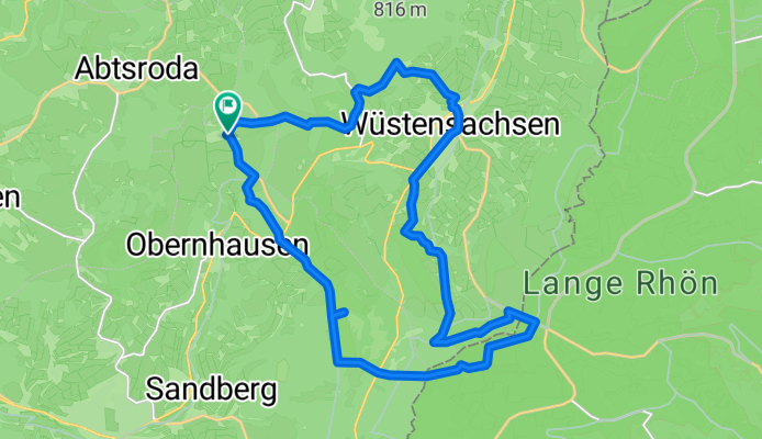
25_Fulda-Quelle – Fulda- Distance
- 36.7 km
- Ascent
- 44 m
- Descent
- 639 m
- Location
- Gersfeld, Hesse, Germany
2015_Berlin - Büttikon_008- Distance
- 108.4 km
- Ascent
- 483 m
- Descent
- 834 m
- Location
- Gersfeld, Hesse, Germany
Fulda Radweg R1- Distance
- 0.2 km
- Ascent
- 0 m
- Descent
- 12 m
- Location
- Gersfeld, Hesse, Germany
Fulda Radweg R1- Distance
- 297.8 km
- Ascent
- 265 m
- Descent
- 1,075 m
- Location
- Gersfeld, Hesse, Germany
Peter-Seifert-Straße 9, Gersfeld (Rhön) nach Am Diechbornsgraben 9, Eichenzell- Distance
- 56.9 km
- Ascent
- 950 m
- Descent
- 1,142 m
- Location
- Gersfeld, Hesse, Germany
Bergtrainingsrunde Rhön- Distance
- 87.2 km
- Ascent
- 1,726 m
- Descent
- 1,564 m
- Location
- Gersfeld, Hesse, Germany
Wasserkuppe nach Wasserkuppe- Distance
- 22.6 km
- Ascent
- 502 m
- Descent
- 505 m
- Location
- Gersfeld, Hesse, Germany
Open it in the app


