
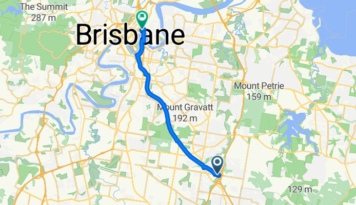
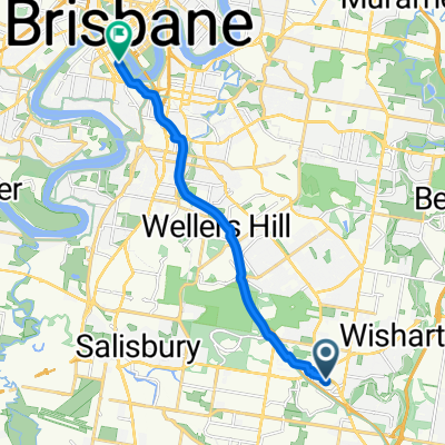
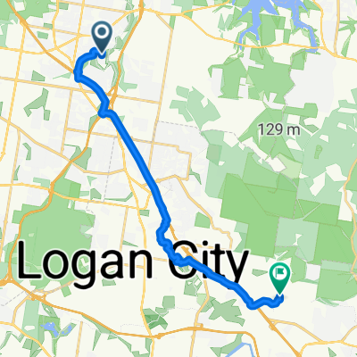
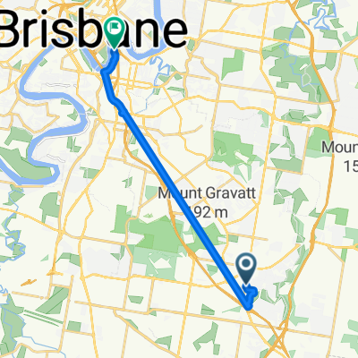
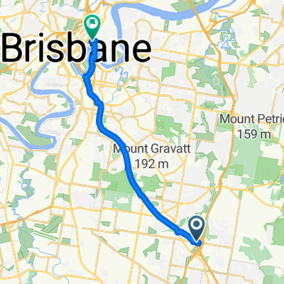
Southeast Busway, Rochedale to Bowen Tce, Fortitude Valley
A cycling route starting in Upper Mount Gravatt, Queensland, Australia.
Overview
About this route
- 1 h 3 min
- Duration
- 18.2 km
- Distance
- 189 m
- Ascent
- 219 m
- Descent
- 17.3 km/h
- Avg. speed
- 97 m
- Max. altitude
Route quality
Waytypes & surfaces along the route
Waytypes
Cycleway
15.1 km
(83 %)
Road
1.5 km
(8 %)
Surfaces
Paved
18 km
(99 %)
Concrete
13.9 km
(76 %)
Asphalt
4 km
(22 %)
Continue with Bikemap
Use, edit, or download this cycling route
You would like to ride Southeast Busway, Rochedale to Bowen Tce, Fortitude Valley or customize it for your own trip? Here is what you can do with this Bikemap route:
Free features
- Save this route as favorite or in collections
- Copy & plan your own version of this route
- Sync your route with Garmin or Wahoo
Premium features
Free trial for 3 days, or one-time payment. More about Bikemap Premium.
- Navigate this route on iOS & Android
- Export a GPX / KML file of this route
- Create your custom printout (try it for free)
- Download this route for offline navigation
Discover more Premium features.
Get Bikemap PremiumFrom our community
Other popular routes starting in Upper Mount Gravatt
 Gateway loop
- Distance
- 56 km
- Ascent
- 235 m
- Descent
- 251 m
- Location
- Upper Mount Gravatt, Queensland, Australia
 Bikeway Eight Mile Plains
- Distance
- 11.5 km
- Ascent
- 65 m
- Descent
- 61 m
- Location
- Upper Mount Gravatt, Queensland, Australia
 2049F Logan Road, Upper Mount Gravatt to Grey Street, South Brisbane
- Distance
- 12.8 km
- Ascent
- 115 m
- Descent
- 165 m
- Location
- Upper Mount Gravatt, Queensland, Australia
 Weekly Ride Extended
- Distance
- 53.2 km
- Ascent
- 316 m
- Descent
- 319 m
- Location
- Upper Mount Gravatt, Queensland, Australia
 Restful route in Upper Mount Gravatt
- Distance
- 11 km
- Ascent
- 73 m
- Descent
- 71 m
- Location
- Upper Mount Gravatt, Queensland, Australia
 From Wishart to Shailer Park
- Distance
- 18.7 km
- Ascent
- 150 m
- Descent
- 141 m
- Location
- Upper Mount Gravatt, Queensland, Australia
 Sporty route in Kangaroo Point
- Distance
- 14.2 km
- Ascent
- 129 m
- Descent
- 161 m
- Location
- Upper Mount Gravatt, Queensland, Australia
 Southeast Busway, Rochedale to Bowen Tce, Fortitude Valley
- Distance
- 18.2 km
- Ascent
- 189 m
- Descent
- 219 m
- Location
- Upper Mount Gravatt, Queensland, Australia
Open it in the app