
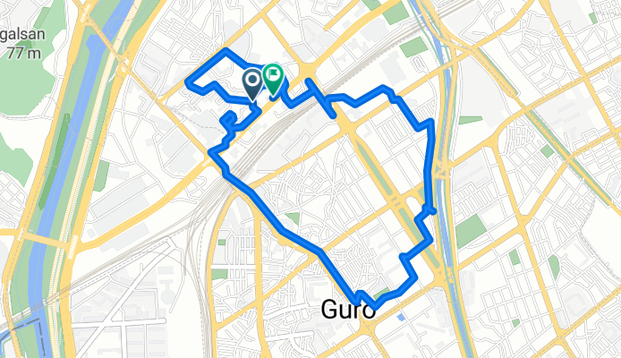
신도림동, 서울특별시에서 신도림동, 서울특별시까지
A cycling route starting in Gwangmyeong, Gyeonggi-do, South Korea.
Overview
About this route
- 54 min
- Duration
- 6.5 km
- Distance
- 152 m
- Ascent
- 155 m
- Descent
- 7.2 km/h
- Avg. speed
- 38 m
- Max. altitude
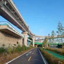
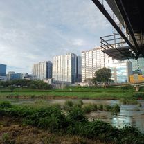
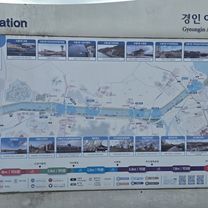
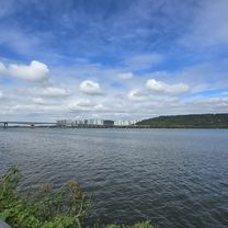
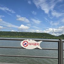
Route photos


Continue with Bikemap
Use, edit, or download this cycling route
You would like to ride 신도림동, 서울특별시에서 신도림동, 서울특별시까지 or customize it for your own trip? Here is what you can do with this Bikemap route:
Free features
- Save this route as favorite or in collections
- Copy & plan your own version of this route
- Sync your route with Garmin or Wahoo
Premium features
Free trial for 3 days, or one-time payment. More about Bikemap Premium.
- Navigate this route on iOS & Android
- Export a GPX / KML file of this route
- Create your custom printout (try it for free)
- Download this route for offline navigation
Discover more Premium features.
Get Bikemap PremiumFrom our community
Other popular routes starting in Gwangmyeong
 2025-9-27 라이딩
- Distance
- 30 km
- Ascent
- 159 m
- Descent
- 187 m
- Location
- Gwangmyeong, Gyeonggi-do, South Korea
![소하동Ph0]으로 라우팅](https://media.bikemap.net/routes/17625573/gallery/thumbs/2a3c9ec6-ac28-4449-bb7b-e0a78a0b8bb1.jpg.208x208_q80_crop.jpg) 소하동Ph0]으로 라우팅
소하동Ph0]으로 라우팅- Distance
- 27.9 km
- Ascent
- 67 m
- Descent
- 84 m
- Location
- Gwangmyeong, Gyeonggi-do, South Korea
 편안한 경로
- Distance
- 32.1 km
- Ascent
- 371 m
- Descent
- 405 m
- Location
- Gwangmyeong, Gyeonggi-do, South Korea
 2025-9-7 라이딩
- Distance
- 18 km
- Ascent
- 123 m
- Descent
- 152 m
- Location
- Gwangmyeong, Gyeonggi-do, South Korea
 신도림동, 서울특별시에서 신도림동, 서울특별시까지
- Distance
- 6.5 km
- Ascent
- 152 m
- Descent
- 155 m
- Location
- Gwangmyeong, Gyeonggi-do, South Korea
 고척동.인천79키로
- Distance
- 79 km
- Ascent
- 234 m
- Descent
- 316 m
- Location
- Gwangmyeong, Gyeonggi-do, South Korea
 안정적인 라이딩
- Distance
- 30.5 km
- Ascent
- 414 m
- Descent
- 450 m
- Location
- Gwangmyeong, Gyeonggi-do, South Korea
 편안한 경로
- Distance
- 29.9 km
- Ascent
- 399 m
- Descent
- 403 m
- Location
- Gwangmyeong, Gyeonggi-do, South Korea
Open it in the app