
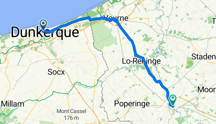
Day 1 A
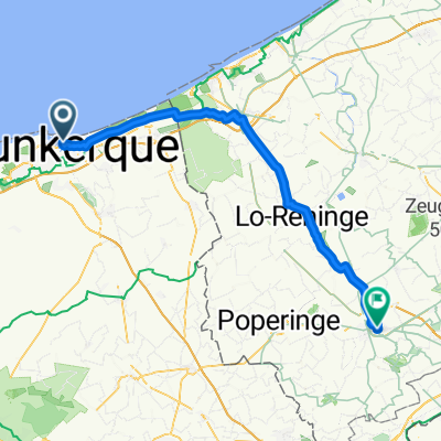
A cycling route starting in Dunkirk, Hauts-de-France, France.
Overview
About this route
- 3 h 24 min
- Duration
- 56.7 km
- Distance
- 39 m
- Ascent
- 19 m
- Descent
- 16.6 km/h
- Avg. speed
- 23 m
- Max. altitude

Continue with Bikemap
Use, edit, or download this cycling route
You would like to ride Day 1 A or customize it for your own trip? Here is what you can do with this Bikemap route:
Free features
- Save this route as favorite or in collections
- Copy & plan your own version of this route
- Sync your route with Garmin or Wahoo
Premium features
Free trial for 3 days, or one-time payment. More about Bikemap Premium.
- Navigate this route on iOS & Android
- Export a GPX / KML file of this route
- Create your custom printout (try it for free)
- Download this route for offline navigation
Discover more Premium features.
Get Bikemap PremiumFrom our community
Other popular routes starting in Dunkirk
 Rue Houchard, Dunkirk to Rue du Docteur Brassart, Arras
- Distance
- 158.5 km
- Ascent
- 517 m
- Descent
- 454 m
- Location
- Dunkirk, Hauts-de-France, France
 Rue du Président Poincaré nach Camping de Calais
- Distance
- 57.6 km
- Ascent
- 49 m
- Descent
- 54 m
- Location
- Dunkirk, Hauts-de-France, France
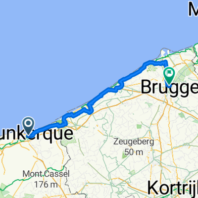
 Dunkerque to Ostend
- Distance
- 49.2 km
- Ascent
- 116 m
- Descent
- 113 m
- Location
- Dunkirk, Hauts-de-France, France
 De Rue du Cent Dixieme Ri à Rue Paul Bert
- Distance
- 74.1 km
- Ascent
- 23 m
- Descent
- 25 m
- Location
- Dunkirk, Hauts-de-France, France
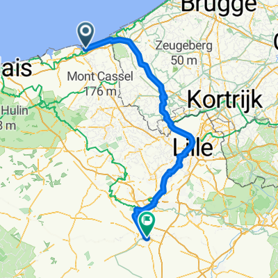
 Dunkirk - Bruges
- Distance
- 99.2 km
- Ascent
- 127 m
- Descent
- 133 m
- Location
- Dunkirk, Hauts-de-France, France
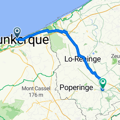 2025 Day01 - Part02
- Distance
- 56.7 km
- Ascent
- 52 m
- Descent
- 31 m
- Location
- Dunkirk, Hauts-de-France, France
 P stage 16..... Dunkerque – Saint-Valery-sur-Somme 6 Sept 2012
- Distance
- 388.2 km
- Ascent
- 455 m
- Descent
- 466 m
- Location
- Dunkirk, Hauts-de-France, France
 Day 1
Day 1- Distance
- 56.4 km
- Ascent
- 51 m
- Descent
- 32 m
- Location
- Dunkirk, Hauts-de-France, France
Open it in the app