

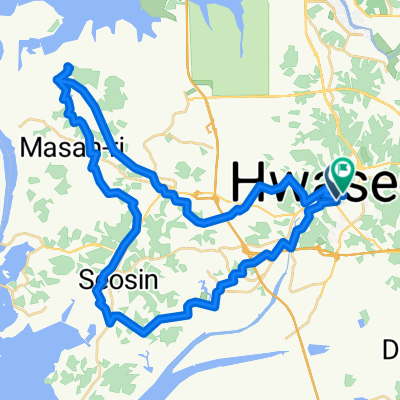
남양읍 15-6 ~ 남양읍 266-21
A cycling route starting in Hwaseong-si, Gyeonggi-do, South Korea.
Overview
About this route
- 8 h 50 min
- Duration
- 236.8 km
- Distance
- 1,284 m
- Ascent
- 1,303 m
- Descent
- 26.8 km/h
- Avg. speed
- 132 m
- Max. altitude
Continue with Bikemap
Use, edit, or download this cycling route
You would like to ride 남양읍 15-6 ~ 남양읍 266-21 or customize it for your own trip? Here is what you can do with this Bikemap route:
Free features
- Save this route as favorite or in collections
- Copy & plan your own version of this route
- Split it into stages to create a multi-day tour
- Sync your route with Garmin or Wahoo
Premium features
Free trial for 3 days, or one-time payment. More about Bikemap Premium.
- Navigate this route on iOS & Android
- Export a GPX / KML file of this route
- Create your custom printout (try it for free)
- Download this route for offline navigation
Discover more Premium features.
Get Bikemap PremiumFrom our community
Other popular routes starting in Hwaseong-si
 Paltan~Hwahongmun~Paltan Route
- Distance
- 44.7 km
- Ascent
- 161 m
- Descent
- 154 m
- Location
- Hwaseong-si, Gyeonggi-do, South Korea
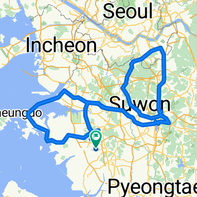
 Ujeong-eup 67-7, Hwaseong-si to Paltan-myeon 산55-13, Hwaseong-si
- Distance
- 506.3 km
- Ascent
- 118 m
- Descent
- 85 m
- Location
- Hwaseong-si, Gyeonggi-do, South Korea
 Mado-myeon 산18, Hwaseong-si to Woram-dong, Uiwang-si
- Distance
- 26.3 km
- Ascent
- 364 m
- Descent
- 343 m
- Location
- Hwaseong-si, Gyeonggi-do, South Korea
![Ph0]에서 경로비봉면 883-12](https://media.bikemap.net/routes/17556965/staticmaps/in_73541a7d-ac11-4d48-bd16-2aea6551a562_400x400_bikemap-2021-3D-static.png) Ph0]에서 경로비봉면 883-12
Ph0]에서 경로비봉면 883-12- Distance
- 8.9 km
- Ascent
- 44 m
- Descent
- 55 m
- Location
- Hwaseong-si, Gyeonggi-do, South Korea
 Bugyang-dong 389-1, Hwaseong-si to Bugyang-dong 389-1, Hwaseong-si
- Distance
- 79.1 km
- Ascent
- 819 m
- Descent
- 822 m
- Location
- Hwaseong-si, Gyeonggi-do, South Korea
 남양리, 화성시에서 남양리, 화성시까지
- Distance
- 52.5 km
- Ascent
- 704 m
- Descent
- 703 m
- Location
- Hwaseong-si, Gyeonggi-do, South Korea
 back to base thru Davis Gate
- Distance
- 14.5 km
- Ascent
- 400 m
- Descent
- 398 m
- Location
- Hwaseong-si, Gyeonggi-do, South Korea
 남양읍 15-6 ~ 남양읍 266-21
- Distance
- 236.8 km
- Ascent
- 1,284 m
- Descent
- 1,303 m
- Location
- Hwaseong-si, Gyeonggi-do, South Korea
Open it in the app