
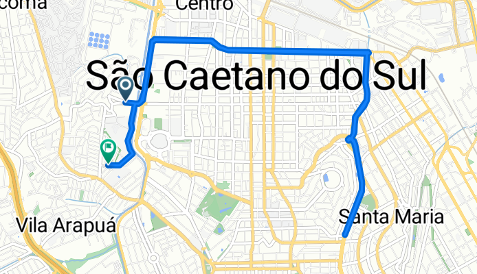
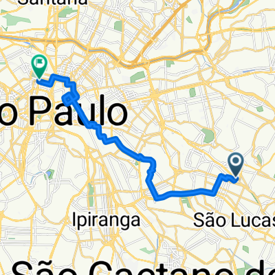
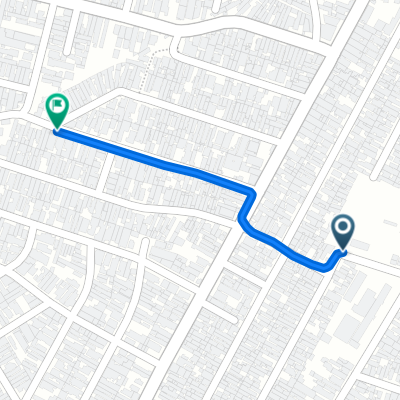
Rua Barbinos, São Paulo a Rua Antônio Anunziato, São Paulo
A cycling route starting in São Caetano do Sul, São Paulo, Brazil.
Overview
About this route
Get ready for a thrilling ride on this scenic 12.9 km cycling adventure! The route gently climbs 56 meters, rewarding you with a delightful descent of 51 meters. As you pedal through the terrain, you'll reach a maximum elevation of 760 meters, offering breathtaking views along the way. Whether you're a casual cyclist or an avid explorer, this path promises an exciting and scenic experience.
AI generated
- 1 h 26 min
- Duration
- 12.9 km
- Distance
- 57 m
- Ascent
- 51 m
- Descent
- 9 km/h
- Avg. speed
- 760 m
- Max. altitude
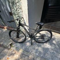
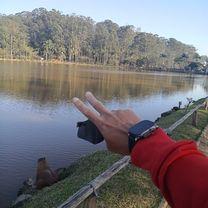
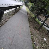
Route photos


Route quality
Waytypes & surfaces along the route
Waytypes
Cycleway
3.9 km
(30 %)
Quiet road
3.5 km
(27 %)
Surfaces
Paved
10.3 km
(80 %)
Asphalt
6.2 km
(48 %)
Concrete
3.9 km
(30 %)
Continue with Bikemap
Use, edit, or download this cycling route
You would like to ride Rua Barbinos, São Paulo a Rua Antônio Anunziato, São Paulo or customize it for your own trip? Here is what you can do with this Bikemap route:
Free features
- Save this route as favorite or in collections
- Copy & plan your own version of this route
- Sync your route with Garmin or Wahoo
Premium features
Free trial for 3 days, or one-time payment. More about Bikemap Premium.
- Navigate this route on iOS & Android
- Export a GPX / KML file of this route
- Create your custom printout (try it for free)
- Download this route for offline navigation
Discover more Premium features.
Get Bikemap PremiumFrom our community
Other popular routes starting in São Caetano do Sul
 caminho melhor para mim
- Distance
- 16.7 km
- Ascent
- 132 m
- Descent
- 161 m
- Location
- São Caetano do Sul, São Paulo, Brazil
 Rua Barbinos, São Paulo a Rua Antônio Anunziato, São Paulo
- Distance
- 12.9 km
- Ascent
- 57 m
- Descent
- 51 m
- Location
- São Caetano do Sul, São Paulo, Brazil
 De Avenida Afonso de Sampaio e Sousa a Avenida Afonso de Sampaio e Sousa
- Distance
- 2.4 km
- Ascent
- 57 m
- Descent
- 27 m
- Location
- São Caetano do Sul, São Paulo, Brazil
 De Avenida Professor Edgar Santos a Avenida Professor Edgar Santos
- Distance
- 4 km
- Ascent
- 107 m
- Descent
- 120 m
- Location
- São Caetano do Sul, São Paulo, Brazil
 De Rua Palmeira Bacaba 277 a Rua Alfavaca 81
- Distance
- 76.5 km
- Ascent
- 445 m
- Descent
- 495 m
- Location
- São Caetano do Sul, São Paulo, Brazil
 De Rua Correia Barros 300 a Rua Cabo Gastão Gama 175
- Distance
- 11.8 km
- Ascent
- 263 m
- Descent
- 149 m
- Location
- São Caetano do Sul, São Paulo, Brazil
 Cavalgada estável
- Distance
- 0.8 km
- Ascent
- 3 m
- Descent
- 27 m
- Location
- São Caetano do Sul, São Paulo, Brazil
 De Rua José Modesto de Godói a Avenida Varsóvia
- Distance
- 18 km
- Ascent
- 155 m
- Descent
- 175 m
- Location
- São Caetano do Sul, São Paulo, Brazil
Open it in the app