

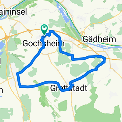
Gochsheim
A cycling route starting in Gochsheim, Bavaria, Germany.
Overview
About this route
Gochsheim Weyer Untereuerheim über den Main Schweinfurt Sennfeld Gochsheim
- -:--
- Duration
- 24.9 km
- Distance
- 107 m
- Ascent
- 107 m
- Descent
- ---
- Avg. speed
- ---
- Max. altitude
Continue with Bikemap
Use, edit, or download this cycling route
You would like to ride Gochsheim or customize it for your own trip? Here is what you can do with this Bikemap route:
Free features
- Save this route as favorite or in collections
- Copy & plan your own version of this route
- Sync your route with Garmin or Wahoo
Premium features
Free trial for 3 days, or one-time payment. More about Bikemap Premium.
- Navigate this route on iOS & Android
- Export a GPX / KML file of this route
- Create your custom printout (try it for free)
- Download this route for offline navigation
Discover more Premium features.
Get Bikemap PremiumFrom our community
Other popular routes starting in Gochsheim
 Zabelstein
- Distance
- 18.8 km
- Ascent
- 237 m
- Descent
- 89 m
- Location
- Gochsheim, Bavaria, Germany
 Gochsheim
- Distance
- 24.9 km
- Ascent
- 107 m
- Descent
- 107 m
- Location
- Gochsheim, Bavaria, Germany
 Gochsheim 20
- Distance
- 20.3 km
- Ascent
- 58 m
- Descent
- 62 m
- Location
- Gochsheim, Bavaria, Germany
 Aufnahme vom 26. Juli 16:01
- Distance
- 23 km
- Ascent
- 120 m
- Descent
- 118 m
- Location
- Gochsheim, Bavaria, Germany
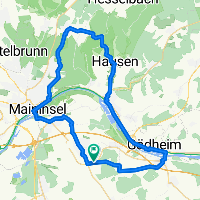 Mädels Tour zum Martin Hausen 1
- Distance
- 34.9 km
- Ascent
- 232 m
- Descent
- 233 m
- Location
- Gochsheim, Bavaria, Germany
 Gochsheim-Unterschütz vom Main zur Tauber
- Distance
- 124.4 km
- Ascent
- 262 m
- Descent
- 278 m
- Location
- Gochsheim, Bavaria, Germany
 Brönnhof
- Distance
- 41.2 km
- Ascent
- 353 m
- Descent
- 353 m
- Location
- Gochsheim, Bavaria, Germany
 Moderate Route in Gochsheim
- Distance
- 18.9 km
- Ascent
- 68 m
- Descent
- 75 m
- Location
- Gochsheim, Bavaria, Germany
Open it in the app