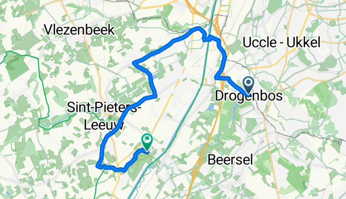

Grand'Route, Drogenbos à Hellestraat, Beersel
- 14.6 km
- 69 m
- 85 m
- Drogenbos, Flemish Region, Belgium
A cycling route starting in Drogenbos, Flemish Region, Belgium.
Overview
created this 2 months ago


Route quality
Quiet road
5.5 km
(38 %)
Road
5.1 km
(35 %)
Paved
6.3 km
(43 %)
Asphalt
5.4 km
(37 %)
Concrete
0.9 km
(6 %)
Undefined
8.3 km
(57 %)
Continue with Bikemap
You would like to ride Grand'Route, Drogenbos à Hellestraat, Beersel or customize it for your own trip? Here is what you can do with this Bikemap route:
Free trial for 3 days, or one-time payment. More about Bikemap Premium.
Discover more Premium features.
Get Bikemap PremiumFrom our community
Open it in the app