
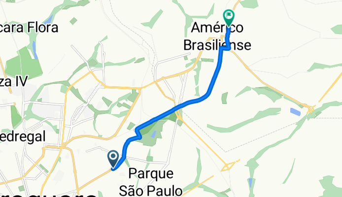
Avenida Francisco Vaz Filho, Araraquara a Rua Orlando Manzeto Pacagnelha, Américo Brasiliense
A cycling route starting in Araraquara, São Paulo, Brazil.
Overview
About this route
Embark on a scenic 8.7 km cycling adventure through picturesque landscapes and rolling hills.
The route offers a delightful mix of paved paths and gentle unpaved sections, making it suitable for cyclists of all levels.
Enjoy a steady ascent of 63 meters and a smooth descent of 65 meters, culminating at a maximum elevation of 747 meters.
Whether you're looking for a leisurely ride or a bit of a challenge, this route provides a rewarding experience with stunning views along the way.
- 39 min
- Duration
- 8.7 km
- Distance
- 63 m
- Ascent
- 65 m
- Descent
- 13.5 km/h
- Avg. speed
- 748 m
- Max. altitude
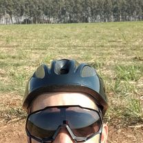
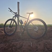
Route photos


Continue with Bikemap
Use, edit, or download this cycling route
You would like to ride Avenida Francisco Vaz Filho, Araraquara a Rua Orlando Manzeto Pacagnelha, Américo Brasiliense or customize it for your own trip? Here is what you can do with this Bikemap route:
Free features
- Save this route as favorite or in collections
- Copy & plan your own version of this route
- Sync your route with Garmin or Wahoo
Premium features
Free trial for 3 days, or one-time payment. More about Bikemap Premium.
- Navigate this route on iOS & Android
- Export a GPX / KML file of this route
- Create your custom printout (try it for free)
- Download this route for offline navigation
Discover more Premium features.
Get Bikemap PremiumFrom our community
Other popular routes starting in Araraquara
 De Rua Aristides Penedo a Rua Aristides Penedo
- Distance
- 18.8 km
- Ascent
- 120 m
- Descent
- 112 m
- Location
- Araraquara, São Paulo, Brazil
 Passeio Ciclístico Araraquara, SP
- Distance
- 10.5 km
- Ascent
- 144 m
- Descent
- 130 m
- Location
- Araraquara, São Paulo, Brazil
 Av. 36 - Araraquara
- Distance
- 2.8 km
- Ascent
- 52 m
- Descent
- 52 m
- Location
- Araraquara, São Paulo, Brazil
 De Rua Clóvis Braga Pinto Ferraz 356 a Avenida José Roberto Tellaroli 47
- Distance
- 12.8 km
- Ascent
- 295 m
- Descent
- 298 m
- Location
- Araraquara, São Paulo, Brazil
 Moderate route in Araraquara
- Distance
- 25.8 km
- Ascent
- 359 m
- Descent
- 291 m
- Location
- Araraquara, São Paulo, Brazil
 Rota da cachoeira - Padoka - Pilão - Adão
- Distance
- 82.4 km
- Ascent
- 730 m
- Descent
- 730 m
- Location
- Araraquara, São Paulo, Brazil
 Bambina - Bueno
- Distance
- 24.4 km
- Ascent
- 216 m
- Descent
- 241 m
- Location
- Araraquara, São Paulo, Brazil
 Araraquara - Ribeirão Bonito
- Distance
- 36.5 km
- Ascent
- 389 m
- Descent
- 429 m
- Location
- Araraquara, São Paulo, Brazil
Open it in the app