
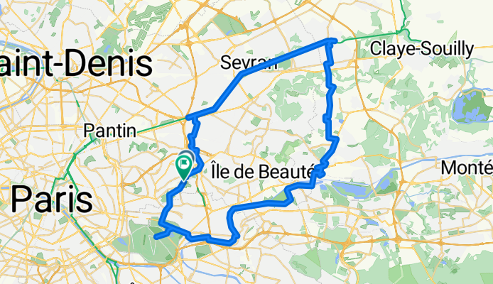
54 k retour polygone
A cycling route starting in Fontenay-sous-Bois, Île-de-France Region, France.
Overview
About this route
- 2 h 57 min
- Duration
- 54.8 km
- Distance
- 221 m
- Ascent
- 221 m
- Descent
- 18.5 km/h
- Avg. speed
- 122 m
- Max. altitude

Route quality
Waytypes & surfaces along the route
Waytypes
Cycleway
25.2 km
(46 %)
Quiet road
14.8 km
(27 %)
Surfaces
Paved
43.8 km
(80 %)
Asphalt
43.3 km
(79 %)
Concrete
0.5 km
(1 %)
Undefined
11 km
(20 %)
Continue with Bikemap
Use, edit, or download this cycling route
You would like to ride 54 k retour polygone or customize it for your own trip? Here is what you can do with this Bikemap route:
Free features
- Save this route as favorite or in collections
- Copy & plan your own version of this route
- Sync your route with Garmin or Wahoo
Premium features
Free trial for 3 days, or one-time payment. More about Bikemap Premium.
- Navigate this route on iOS & Android
- Export a GPX / KML file of this route
- Create your custom printout (try it for free)
- Download this route for offline navigation
Discover more Premium features.
Get Bikemap PremiumFrom our community
Other popular routes starting in Fontenay-sous-Bois
 21 Rue des Mocards, Fontenay-sous-Bois à 1 Rue de la République, Charenton-le-Pont
- Distance
- 6.3 km
- Ascent
- 98 m
- Descent
- 119 m
- Location
- Fontenay-sous-Bois, Île-de-France Region, France
 54 k retour polygone
- Distance
- 54.8 km
- Ascent
- 221 m
- Descent
- 221 m
- Location
- Fontenay-sous-Bois, Île-de-France Region, France
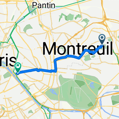
 De Boulevard Théophile Sueur à Boulevard Théophile Sueur
- Distance
- 37.4 km
- Ascent
- 204 m
- Descent
- 204 m
- Location
- Fontenay-sous-Bois, Île-de-France Region, France
 48 Rue du Commandant Jean Duhail, Fontenay-sous-Bois à 9 Quai de Bercy, Charenton-le-Pont
- Distance
- 7.7 km
- Ascent
- 27 m
- Descent
- 53 m
- Location
- Fontenay-sous-Bois, Île-de-France Region, France
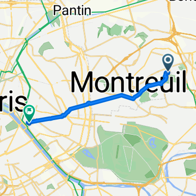 home - Gare de Lyon
- Distance
- 9.1 km
- Ascent
- 33 m
- Descent
- 104 m
- Location
- Fontenay-sous-Bois, Île-de-France Region, France
 Fontenay _ Villenoy
- Distance
- 44.5 km
- Ascent
- 74 m
- Descent
- 127 m
- Location
- Fontenay-sous-Bois, Île-de-France Region, France
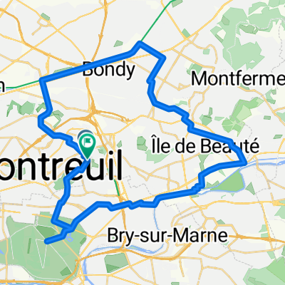
 boucle 65 km Montreuil
- Distance
- 65.2 km
- Ascent
- 393 m
- Descent
- 393 m
- Location
- Fontenay-sous-Bois, Île-de-France Region, France
 Boulevard Théophile Sueur, Montreuil à Place Louis Armand, Paris
- Distance
- 10.1 km
- Ascent
- 39 m
- Descent
- 109 m
- Location
- Fontenay-sous-Bois, Île-de-France Region, France
Open it in the app