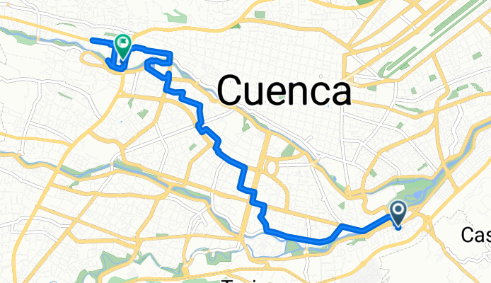
Turubamba, Cuenca to Victor Manuel Albornoz, Cuenca
A cycling route starting in Cuenca, Azuay, Ecuador.
Overview
About this route
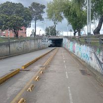
Embark on an exhilarating cycling adventure through picturesque landscapes as you pedal along this scenic route. The journey spans 9.8 kilometers, offering a delightful mix of gentle inclines and thrilling descents. With an elevation gain of 126 meters, you'll appreciate the beauty of the surroundings as you ascend to a maximum elevation of 2587 meters. While enjoying the scenic views, anticipate a descent of 64 meters, providing a perfect balance of challenge and enjoyment. Whether you're a seasoned cyclist or a casual rider, this route promises an unforgettable experience filled with stunning vistas and invigorating exercise.
AI generated
- 2 h 46 min
- Duration
- 9.8 km
- Distance
- 127 m
- Ascent
- 65 m
- Descent
- 3.5 km/h
- Avg. speed
- 2,588 m
- Max. altitude
Route photos
Continue with Bikemap
Use, edit, or download this cycling route
You would like to ride Turubamba, Cuenca to Victor Manuel Albornoz, Cuenca or customize it for your own trip? Here is what you can do with this Bikemap route:
Free features
- Save this route as favorite or in collections
- Copy & plan your own version of this route
- Sync your route with Garmin or Wahoo
Premium features
Free trial for 3 days, or one-time payment. More about Bikemap Premium.
- Navigate this route on iOS & Android
- Export a GPX / KML file of this route
- Create your custom printout (try it for free)
- Download this route for offline navigation
Discover more Premium features.
Get Bikemap PremiumFrom our community
Other popular routes starting in Cuenca
De Diego de Almagro, Cuenca a Avenida Mirador de Turi, Cuenca- Distance
- 6 km
- Ascent
- 193 m
- Descent
- 89 m
- Location
- Cuenca, Azuay, Ecuador
Turubamba, Cuenca to Victor Manuel Albornoz, Cuenca- Distance
- 9.8 km
- Ascent
- 127 m
- Descent
- 65 m
- Location
- Cuenca, Azuay, Ecuador
totoracoha a Solano- Distance
- 14.7 km
- Ascent
- 153 m
- Descent
- 102 m
- Location
- Cuenca, Azuay, Ecuador
ruta1 juegos nacionales 2013- Distance
- 2.5 km
- Ascent
- 293 m
- Descent
- 293 m
- Location
- Cuenca, Azuay, Ecuador
De Saraurco 106, Cuenca a Saraurco 106, Cuenca- Distance
- 29 km
- Ascent
- 1,214 m
- Descent
- 1,214 m
- Location
- Cuenca, Azuay, Ecuador
De 5XPX+J4C, Chiquintad a Parque Central de Chiquintad- Distance
- 52.8 km
- Ascent
- 5,997 m
- Descent
- 5,993 m
- Location
- Cuenca, Azuay, Ecuador
Ruta nocturna Dev 593- Distance
- 11.7 km
- Ascent
- 105 m
- Descent
- 114 m
- Location
- Cuenca, Azuay, Ecuador
Ruta a Del Bandoneón 59, Cuenca- Distance
- 21.2 km
- Ascent
- 257 m
- Descent
- 134 m
- Location
- Cuenca, Azuay, Ecuador
Open it in the app

