
"excursión" a la herrería
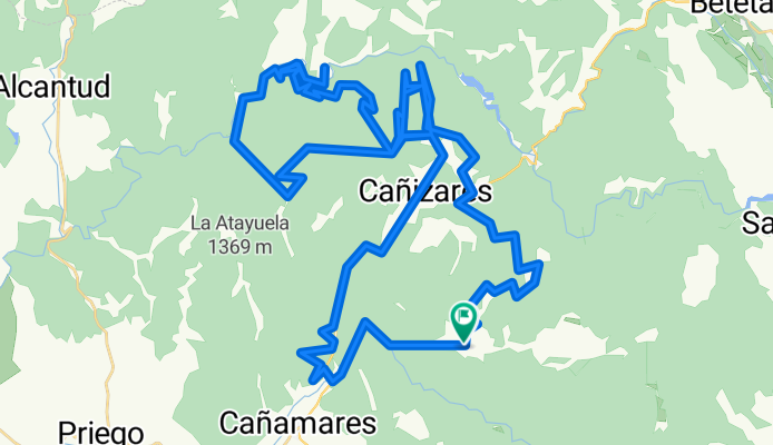
A cycling route starting in Fuertescusa, Castille-La Mancha, Spain.
Overview
About this route
- 19 h 3 min
- Duration
- 79.3 km
- Distance
- 2,237 m
- Ascent
- 2,238 m
- Descent
- 4.2 km/h
- Avg. speed
- 1,287 m
- Max. altitude

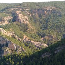
Route photos

Route quality
Waytypes & surfaces along the route
Waytypes
Track
55.5 km
(70 %)
Road
9.5 km
(12 %)
Surfaces
Paved
0.8 km
(1 %)
Unpaved
32.5 km
(41 %)
Gravel
12.7 km
(16 %)
Ground
11.1 km
(14 %)
Continue with Bikemap
Use, edit, or download this cycling route
You would like to ride "excursión" a la herrería or customize it for your own trip? Here is what you can do with this Bikemap route:
Free features
- Save this route as favorite or in collections
- Copy & plan your own version of this route
- Sync your route with Garmin or Wahoo
Premium features
Free trial for 3 days, or one-time payment. More about Bikemap Premium.
- Navigate this route on iOS & Android
- Export a GPX / KML file of this route
- Create your custom printout (try it for free)
- Download this route for offline navigation
Discover more Premium features.
Get Bikemap PremiumFrom our community
Other popular routes starting in Fuertescusa
 SdC - Fuertescusa - Huélamo
- Distance
- 60.5 km
- Ascent
- 1,791 m
- Descent
- 1,555 m
- Location
- Fuertescusa, Castille-La Mancha, Spain
 Fuertescusa - Godojos
- Distance
- 132.8 km
- Ascent
- 2,874 m
- Descent
- 3,093 m
- Location
- Fuertescusa, Castille-La Mancha, Spain
 mirador el águila - la herrería - ermita el pozuelo
- Distance
- 66 km
- Ascent
- 1,782 m
- Descent
- 1,780 m
- Location
- Fuertescusa, Castille-La Mancha, Spain
 De Calle San Sebastian 24, Fuertescusa a CM-210 41, Cañizares
- Distance
- 10.7 km
- Ascent
- 308 m
- Descent
- 240 m
- Location
- Fuertescusa, Castille-La Mancha, Spain
 "excursión" a la herrería
- Distance
- 79.3 km
- Ascent
- 2,237 m
- Descent
- 2,238 m
- Location
- Fuertescusa, Castille-La Mancha, Spain
 Ruta desde Calle Real 3, Fuertescusa
- Distance
- 4.3 km
- Ascent
- 281 m
- Descent
- 63 m
- Location
- Fuertescusa, Castille-La Mancha, Spain
 SERRANIA CELTIBERICA ETAPA 2 DEFINITIVA
- Distance
- 318 km
- Ascent
- 3,090 m
- Descent
- 3,468 m
- Location
- Fuertescusa, Castille-La Mancha, Spain
 cañamares ermita de el pozuelo
- Distance
- 59.6 km
- Ascent
- 855 m
- Descent
- 852 m
- Location
- Fuertescusa, Castille-La Mancha, Spain
Open it in the app