
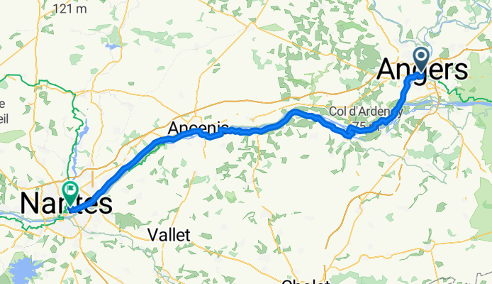
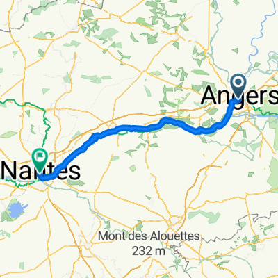
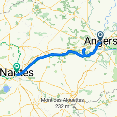
Square Jean Monnet, Angers nach Boulevard de l'Europe, Nantes
A cycling route starting in Angers, Pays de la Loire Region, France.
Overview
About this route
Embark on an exhilarating cycling adventure along this 104.3 km route, perfect for those seeking a blend of challenge and scenery. Starting at a moderate elevation of 60 meters, you'll climb a total of 222 meters and descend 237 meters, ensuring a dynamic ride with plenty of excitement. This path offers a mix of paved and unpaved surfaces, providing a variety of textures and terrains to explore. As you pedal, enjoy the ever-changing landscape and the thrill of conquering the route's gentle slopes and descents. Whether you're a seasoned cyclist or a casual rider, this journey promises an engaging experience for all levels.
AI generated
- 7 h 2 min
- Duration
- 104.3 km
- Distance
- 222 m
- Ascent
- 238 m
- Descent
- 14.8 km/h
- Avg. speed
- 61 m
- Max. altitude

Route photos


Route quality
Waytypes & surfaces along the route
Waytypes
Quiet road
37.6 km
(36 %)
Road
17.7 km
(17 %)
Surfaces
Paved
77.2 km
(74 %)
Unpaved
21.9 km
(21 %)
Asphalt
74.1 km
(71 %)
Gravel
13.6 km
(13 %)
Continue with Bikemap
Use, edit, or download this cycling route
You would like to ride Square Jean Monnet, Angers nach Boulevard de l'Europe, Nantes or customize it for your own trip? Here is what you can do with this Bikemap route:
Free features
- Save this route as favorite or in collections
- Copy & plan your own version of this route
- Split it into stages to create a multi-day tour
- Sync your route with Garmin or Wahoo
Premium features
Free trial for 3 days, or one-time payment. More about Bikemap Premium.
- Navigate this route on iOS & Android
- Export a GPX / KML file of this route
- Create your custom printout (try it for free)
- Download this route for offline navigation
Discover more Premium features.
Get Bikemap PremiumFrom our community
Other popular routes starting in Angers
 grez neuville
- Distance
- 53.2 km
- Ascent
- 260 m
- Descent
- 258 m
- Location
- Angers, Pays de la Loire Region, France
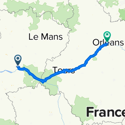 EU 6 2 Angers to Orleans
- Distance
- 260.9 km
- Ascent
- 939 m
- Descent
- 849 m
- Location
- Angers, Pays de la Loire Region, France
 Day 7, Angers to Saint-Florent-le-Vieil
- Distance
- 48.9 km
- Ascent
- 229 m
- Descent
- 228 m
- Location
- Angers, Pays de la Loire Region, France
 petit tour pepouze
- Distance
- 58.3 km
- Ascent
- 368 m
- Descent
- 368 m
- Location
- Angers, Pays de la Loire Region, France
 Angers - Jumelles
- Distance
- 51.3 km
- Ascent
- 356 m
- Descent
- 371 m
- Location
- Angers, Pays de la Loire Region, France
 Von Angers bis Nantes
- Distance
- 104 km
- Ascent
- 323 m
- Descent
- 348 m
- Location
- Angers, Pays de la Loire Region, France
 2025 Fahrradtour nach Strand von Ingrandes - Tag 17 - von Angers nach Nantes
- Distance
- 110.9 km
- Ascent
- 170 m
- Descent
- 175 m
- Location
- Angers, Pays de la Loire Region, France
 6 giugno
- Distance
- 61.5 km
- Ascent
- 177 m
- Descent
- 150 m
- Location
- Angers, Pays de la Loire Region, France
Open it in the app