
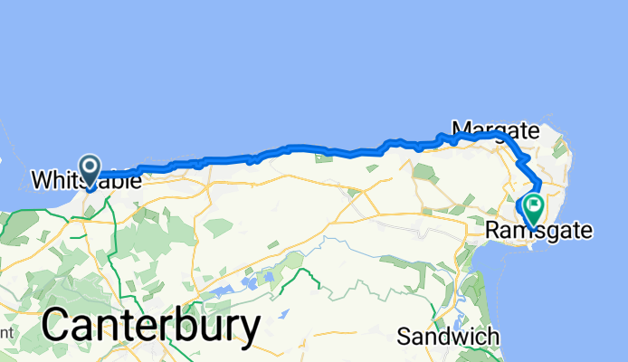
Oxford Street to High Street
A cycling route starting in Whitstable, England, United Kingdom.
Overview
About this route
- 2 h 21 min
- Duration
- 39.3 km
- Distance
- 222 m
- Ascent
- 206 m
- Descent
- 16.7 km/h
- Avg. speed
- 52 m
- Max. altitude

Route quality
Waytypes & surfaces along the route
Waytypes
Cycleway
26.7 km
(68 %)
Quiet road
9.4 km
(24 %)
Surfaces
Paved
34.9 km
(89 %)
Unpaved
1.2 km
(3 %)
Asphalt
17.7 km
(45 %)
Concrete
15.7 km
(40 %)
Continue with Bikemap
Use, edit, or download this cycling route
You would like to ride Oxford Street to High Street or customize it for your own trip? Here is what you can do with this Bikemap route:
Free features
- Save this route as favorite or in collections
- Copy & plan your own version of this route
- Sync your route with Garmin or Wahoo
Premium features
Free trial for 3 days, or one-time payment. More about Bikemap Premium.
- Navigate this route on iOS & Android
- Export a GPX / KML file of this route
- Create your custom printout (try it for free)
- Download this route for offline navigation
Discover more Premium features.
Get Bikemap PremiumFrom our community
Other popular routes starting in Whitstable
 Viking Bay
- Distance
- 78.5 km
- Ascent
- 179 m
- Descent
- 169 m
- Location
- Whitstable, England, United Kingdom
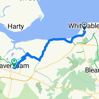 Ride back from Whitstable
- Distance
- 14.7 km
- Ascent
- 36 m
- Descent
- 40 m
- Location
- Whitstable, England, United Kingdom
 Old Farm Close 6 to Hicks Forstal Road
- Distance
- 11.6 km
- Ascent
- 77 m
- Descent
- 84 m
- Location
- Whitstable, England, United Kingdom
 whit cant
- Distance
- 38.8 km
- Ascent
- 271 m
- Descent
- 272 m
- Location
- Whitstable, England, United Kingdom
 Canterbury and Stodmarsh
- Distance
- 50.7 km
- Ascent
- 271 m
- Descent
- 271 m
- Location
- Whitstable, England, United Kingdom
 Seasalter Lane 96 to Harbour Parade 54
- Distance
- 55 km
- Ascent
- 28 m
- Descent
- 75 m
- Location
- Whitstable, England, United Kingdom
 Linnet Avenue 7 to Linnet Avenue 13
- Distance
- 50.8 km
- Ascent
- 391 m
- Descent
- 392 m
- Location
- Whitstable, England, United Kingdom
 Faversham Road 28, Seasalter to Island Wall 2
- Distance
- 102.6 km
- Ascent
- 387 m
- Descent
- 393 m
- Location
- Whitstable, England, United Kingdom
Open it in the app