
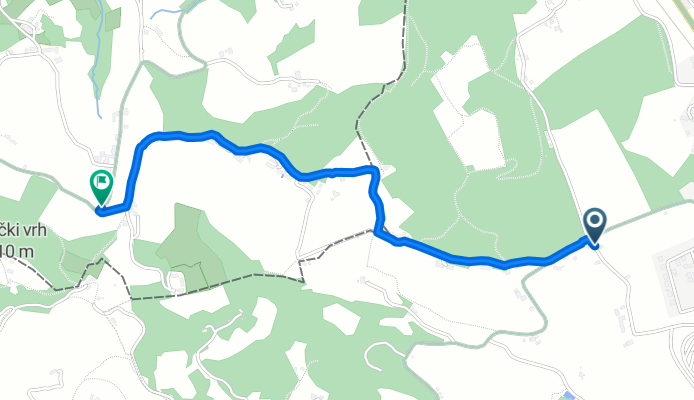
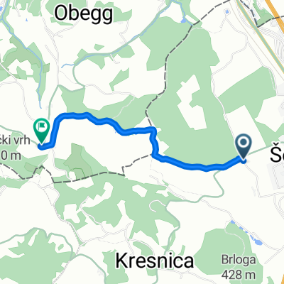
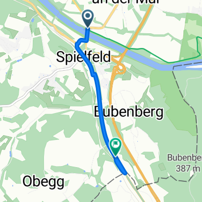
Sadjarska pot, Šentilj v Slovenskih Goricah nach Am Graßnitzberg, Straß in Steiermark
A cycling route starting in Šentilj, Občina Šentilj, Slovenia.
Overview
About this route
- 36 min
- Duration
- 2.5 km
- Distance
- 98 m
- Ascent
- 77 m
- Descent
- 4.2 km/h
- Avg. speed
- 441 m
- Max. altitude

Route quality
Waytypes & surfaces along the route
Waytypes
Quiet road
1.8 km
(71 %)
Access road
0.6 km
(26 %)
Track
0.1 km
(3 %)
Surfaces
Paved
0.3 km
(13 %)
Unpaved
0.4 km
(18 %)
Unpaved (undefined)
0.4 km
(18 %)
Asphalt
0.3 km
(13 %)
Undefined
1.7 km
(69 %)
Continue with Bikemap
Use, edit, or download this cycling route
You would like to ride Sadjarska pot, Šentilj v Slovenskih Goricah nach Am Graßnitzberg, Straß in Steiermark or customize it for your own trip? Here is what you can do with this Bikemap route:
Free features
- Save this route as favorite or in collections
- Copy & plan your own version of this route
- Sync your route with Garmin or Wahoo
Premium features
Free trial for 3 days, or one-time payment. More about Bikemap Premium.
- Navigate this route on iOS & Android
- Export a GPX / KML file of this route
- Create your custom printout (try it for free)
- Download this route for offline navigation
Discover more Premium features.
Get Bikemap PremiumFrom our community
Other popular routes starting in Šentilj
 Šentilj-Svečina- Gaj nad MB- Jakob- Šentilj
- Distance
- 69.9 km
- Ascent
- 986 m
- Descent
- 988 m
- Location
- Šentilj, Občina Šentilj, Slovenia
 Šentilj - Murska Sobota
- Distance
- 55 km
- Ascent
- 32 m
- Descent
- 137 m
- Location
- Šentilj, Občina Šentilj, Slovenia
 ŠENTILJ - SPIELFELD - CMUREK - FELDBACH - RIGERSBURG - FELDBACH - SAAZ - SANKT STEFAN AM ROSENTHAL - GLATZAU - ZIPREIN - SEIBUTTENDORF - RAGNITZ - LEIBNITZ - SP
- Distance
- 137 km
- Ascent
- 586 m
- Descent
- 585 m
- Location
- Šentilj, Občina Šentilj, Slovenia
 Sadjarska pot, Šentilj v Slovenskih Goricah nach Am Graßnitzberg, Straß in Steiermark
- Distance
- 2.5 km
- Ascent
- 98 m
- Descent
- 77 m
- Location
- Šentilj, Občina Šentilj, Slovenia
 Hochgrassnitzbergweg, Straß in Steiermark nach Hochgraßnitzberg, Straß in Steiermark
- Distance
- 0.7 km
- Ascent
- 25 m
- Descent
- 16 m
- Location
- Šentilj, Občina Šentilj, Slovenia
 Šentilj - Polzela
- Distance
- 112.1 km
- Ascent
- 1,178 m
- Descent
- 1,221 m
- Location
- Šentilj, Občina Šentilj, Slovenia
 Šentilj-Dobrovnik
- Distance
- 67 km
- Ascent
- 53 m
- Descent
- 205 m
- Location
- Šentilj, Občina Šentilj, Slovenia
 EuroVelo 9 AT Stage 6: Šentilj to Spielfeld
- Distance
- 2.6 km
- Ascent
- 35 m
- Descent
- 7 m
- Location
- Šentilj, Občina Šentilj, Slovenia
Open it in the app