
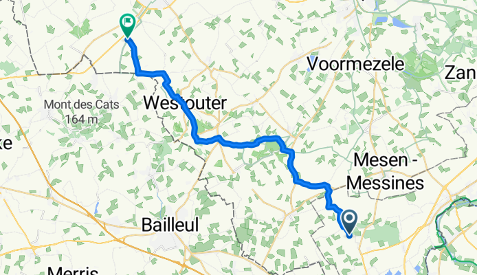
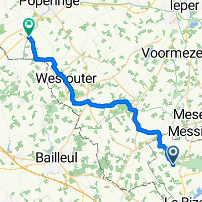
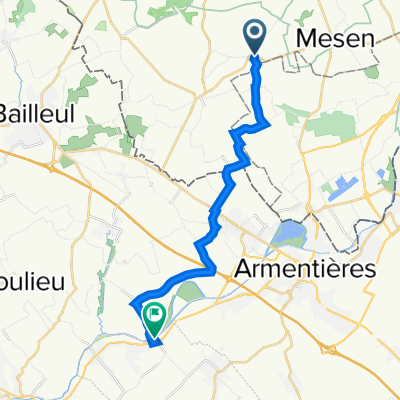
Ploegsteert Memorial to Lijssenthoek Memorial
A cycling route starting in Saint-Yvon, Flemish Region, Belgium.
Overview
About this route
- 1 h 16 min
- Duration
- 21.1 km
- Distance
- 205 m
- Ascent
- 198 m
- Descent
- 16.6 km/h
- Avg. speed
- 113 m
- Max. altitude

Route quality
Waytypes & surfaces along the route
Waytypes
Quiet road
17.9 km
(85 %)
Cycleway
1.7 km
(8 %)
Surfaces
Paved
13.9 km
(66 %)
Unpaved
0.6 km
(3 %)
Asphalt
13.9 km
(66 %)
Ground
0.6 km
(3 %)
Undefined
6.5 km
(31 %)
Continue with Bikemap
Use, edit, or download this cycling route
You would like to ride Ploegsteert Memorial to Lijssenthoek Memorial or customize it for your own trip? Here is what you can do with this Bikemap route:
Free features
- Save this route as favorite or in collections
- Copy & plan your own version of this route
- Sync your route with Garmin or Wahoo
Premium features
Free trial for 3 days, or one-time payment. More about Bikemap Premium.
- Navigate this route on iOS & Android
- Export a GPX / KML file of this route
- Create your custom printout (try it for free)
- Download this route for offline navigation
Discover more Premium features.
Get Bikemap PremiumFrom our community
Other popular routes starting in Saint-Yvon
 Heuvelland
- Distance
- 48 km
- Ascent
- 523 m
- Descent
- 522 m
- Location
- Saint-Yvon, Flemish Region, Belgium
 de vierpot1a - 45.5
- Distance
- 45.5 km
- Ascent
- 524 m
- Descent
- 525 m
- Location
- Saint-Yvon, Flemish Region, Belgium
 de vierpot1 - 46.6
- Distance
- 46.6 km
- Ascent
- 492 m
- Descent
- 491 m
- Location
- Saint-Yvon, Flemish Region, Belgium
 Ploegsteert Memorial to Lijssenthoek Memorial
- Distance
- 21.1 km
- Ascent
- 205 m
- Descent
- 198 m
- Location
- Saint-Yvon, Flemish Region, Belgium
 heuvelland totaal
- Distance
- 220 km
- Ascent
- 1,918 m
- Descent
- 1,940 m
- Location
- Saint-Yvon, Flemish Region, Belgium
 2022 IEPER - ARRAS Deel 2
- Distance
- 16 km
- Ascent
- 16 m
- Descent
- 29 m
- Location
- Saint-Yvon, Flemish Region, Belgium
 gent wevelgem in flanders fields
- Distance
- 76.1 km
- Ascent
- 684 m
- Descent
- 685 m
- Location
- Saint-Yvon, Flemish Region, Belgium
 westvlaamse bergenroute - 58.7
- Distance
- 58.7 km
- Ascent
- 379 m
- Descent
- 379 m
- Location
- Saint-Yvon, Flemish Region, Belgium
Open it in the app