
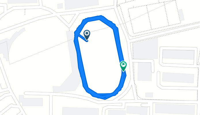
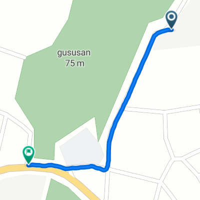
대현동, 대구광역시에서 대현동, 대구광역시까지
A cycling route starting in Daegu, Daegu, South Korea.
Overview
About this route
- 27 min
- Duration
- 4 km
- Distance
- 14 m
- Ascent
- 9 m
- Descent
- 8.8 km/h
- Avg. speed
- 45 m
- Max. altitude
Continue with Bikemap
Use, edit, or download this cycling route
You would like to ride 대현동, 대구광역시에서 대현동, 대구광역시까지 or customize it for your own trip? Here is what you can do with this Bikemap route:
Free features
- Save this route as favorite or in collections
- Copy & plan your own version of this route
- Sync your route with Garmin or Wahoo
Premium features
Free trial for 3 days, or one-time payment. More about Bikemap Premium.
- Navigate this route on iOS & Android
- Export a GPX / KML file of this route
- Create your custom printout (try it for free)
- Download this route for offline navigation
Discover more Premium features.
Get Bikemap PremiumFrom our community
Other popular routes starting in Daegu
 남산로7길, 대구광역시에서 남산동, 대구광역시까지
- Distance
- 7.5 km
- Ascent
- 183 m
- Descent
- 214 m
- Location
- Daegu, Daegu, South Korea
 보통 경로
보통 경로- Distance
- 37.7 km
- Ascent
- 236 m
- Descent
- 251 m
- Location
- Daegu, Daegu, South Korea
 평리동, 대구광역시에서 계양로35길, 경산시까지
- Distance
- 21.8 km
- Ascent
- 162 m
- Descent
- 138 m
- Location
- Daegu, Daegu, South Korea
 10-15 10-15 ~ 화양읍
- Distance
- 48.8 km
- Ascent
- 697 m
- Descent
- 585 m
- Location
- Daegu, Daegu, South Korea
 할미집에서 아양교까지
- Distance
- 2.4 km
- Ascent
- 10 m
- Descent
- 15 m
- Location
- Daegu, Daegu, South Korea
 효목동, 대구광역시에서 효목동, 대구광역시까지
- Distance
- 7.7 km
- Ascent
- 56 m
- Descent
- 61 m
- Location
- Daegu, Daegu, South Korea
 대천로7길, 대구광역시에서 관음동, 대구광역시까지
- Distance
- 0.9 km
- Ascent
- 6 m
- Descent
- 6 m
- Location
- Daegu, Daegu, South Korea
 대현동, 대구광역시에서 대현동, 대구광역시까지
- Distance
- 4 km
- Ascent
- 14 m
- Descent
- 9 m
- Location
- Daegu, Daegu, South Korea
Open it in the app