
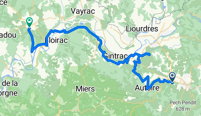
ETAPE 3 : DORDOGNE
A cycling route starting in Saint-Céré, Occitanie, France.
Overview
About this route
- 2 h 59 min
- Duration
- 46.8 km
- Distance
- 1,174 m
- Ascent
- 1,102 m
- Descent
- 15.7 km/h
- Avg. speed
- 339 m
- Max. altitude
Route quality
Waytypes & surfaces along the route
Waytypes
Road
22.5 km
(48 %)
Quiet road
18.3 km
(39 %)
Surfaces
Paved
14.5 km
(31 %)
Asphalt
14.5 km
(31 %)
Undefined
32.3 km
(69 %)
Continue with Bikemap
Use, edit, or download this cycling route
You would like to ride ETAPE 3 : DORDOGNE or customize it for your own trip? Here is what you can do with this Bikemap route:
Free features
- Save this route as favorite or in collections
- Copy & plan your own version of this route
- Sync your route with Garmin or Wahoo
Premium features
Free trial for 3 days, or one-time payment. More about Bikemap Premium.
- Navigate this route on iOS & Android
- Export a GPX / KML file of this route
- Create your custom printout (try it for free)
- Download this route for offline navigation
Discover more Premium features.
Get Bikemap PremiumFrom our community
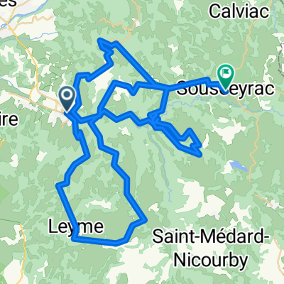
Other popular routes starting in Saint-Céré
 St. Cere - Gourdon (Nr. 92)
- Distance
- 63.3 km
- Ascent
- 770 m
- Descent
- 695 m
- Location
- Saint-Céré, Occitanie, France
 Saint-Laurent-Saint-Paul-De-Vernes
- Distance
- 26.6 km
- Ascent
- 813 m
- Descent
- 818 m
- Location
- Saint-Céré, Occitanie, France
 Collines aux alentours de Saint-Céré
- Distance
- 84.5 km
- Ascent
- 1,741 m
- Descent
- 1,336 m
- Location
- Saint-Céré, Occitanie, France
 Saint-Céré 1, cœur de ville
- Distance
- 3.3 km
- Ascent
- 0 m
- Descent
- 0 m
- Location
- Saint-Céré, Occitanie, France
 distribution st Laurent 1
- Distance
- 5.9 km
- Ascent
- 55 m
- Descent
- 141 m
- Location
- Saint-Céré, Occitanie, France
 Sousceyrac-Sarlat la Caneda
- Distance
- 99.5 km
- Ascent
- 736 m
- Descent
- 1,154 m
- Location
- Saint-Céré, Occitanie, France
 Sant Seren
- Distance
- 49.5 km
- Ascent
- 584 m
- Descent
- 585 m
- Location
- Saint-Céré, Occitanie, France
 Saint-Jean 17Km 500D+
- Distance
- 17.1 km
- Ascent
- 540 m
- Descent
- 554 m
- Location
- Saint-Céré, Occitanie, France
Open it in the app