
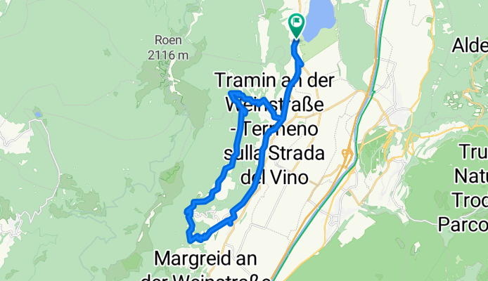
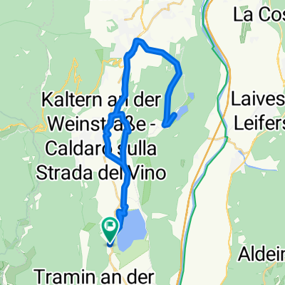
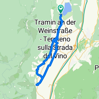
Camping St. Josef - Tramin - Kurtatsch - Graun - St.Josef
A cycling route starting in Termeno, Trentino-Alto Adige, Italy.
Overview
About this route
- 1 h 59 min
- Duration
- 25 km
- Distance
- 1,014 m
- Ascent
- 1,013 m
- Descent
- 12.6 km/h
- Avg. speed
- 873 m
- Max. altitude

Route quality
Waytypes & surfaces along the route
Waytypes
Quiet road
14.7 km
(59 %)
Track
6 km
(24 %)
Surfaces
Paved
11 km
(44 %)
Unpaved
4.7 km
(19 %)
Asphalt
10.2 km
(41 %)
Gravel
4.5 km
(18 %)
Continue with Bikemap
Use, edit, or download this cycling route
You would like to ride Camping St. Josef - Tramin - Kurtatsch - Graun - St.Josef or customize it for your own trip? Here is what you can do with this Bikemap route:
Free features
- Save this route as favorite or in collections
- Copy & plan your own version of this route
- Sync your route with Garmin or Wahoo
Premium features
Free trial for 3 days, or one-time payment. More about Bikemap Premium.
- Navigate this route on iOS & Android
- Export a GPX / KML file of this route
- Create your custom printout (try it for free)
- Download this route for offline navigation
Discover more Premium features.
Get Bikemap PremiumFrom our community
Other popular routes starting in Termeno
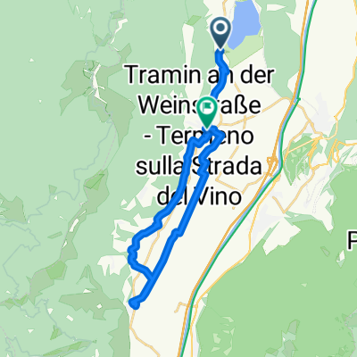
 Kaltererseestraße, Tramin an der Weinstraße nach Laimburg, Auer
- Distance
- 6.9 km
- Ascent
- 51 m
- Descent
- 101 m
- Location
- Termeno, Trentino-Alto Adige, Italy
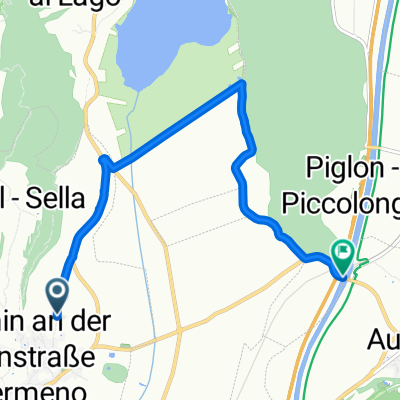
 Auffahrt zum Lenzenhof
- Distance
- 7.9 km
- Ascent
- 591 m
- Descent
- 76 m
- Location
- Termeno, Trentino-Alto Adige, Italy
 Kaltern an der Weinstraße nach Europastraße, Kaltern an der Weinstraße
- Distance
- 5.8 km
- Ascent
- 287 m
- Descent
- 13 m
- Location
- Termeno, Trentino-Alto Adige, Italy
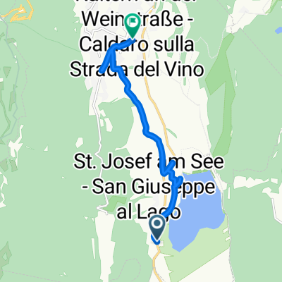 Sankt Josef am See, Kaltern an der Weinstraße nach Marktplatz, Kaltern an der Weinstraße
- Distance
- 7.9 km
- Ascent
- 288 m
- Descent
- 76 m
- Location
- Termeno, Trentino-Alto Adige, Italy
 St.Joseph-Kurtatsch-Margreid-Entiklar-Tramin-St.Josepg
- Distance
- 21.6 km
- Ascent
- 399 m
- Descent
- 335 m
- Location
- Termeno, Trentino-Alto Adige, Italy
 Josef Von Zallinger Straße nach Weingartenweg
- Distance
- 37.6 km
- Ascent
- 221 m
- Descent
- 199 m
- Location
- Termeno, Trentino-Alto Adige, Italy
 Sankt Josef-Montiggl-St.Joseph am See
- Distance
- 32.6 km
- Ascent
- 561 m
- Descent
- 561 m
- Location
- Termeno, Trentino-Alto Adige, Italy
 Sankt Josef am See, Kaltern an der Weinstraße nach Sankt Josef am See, Kaltern an der Weinstraße
- Distance
- 26.3 km
- Ascent
- 451 m
- Descent
- 452 m
- Location
- Termeno, Trentino-Alto Adige, Italy
Open it in the app