
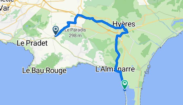
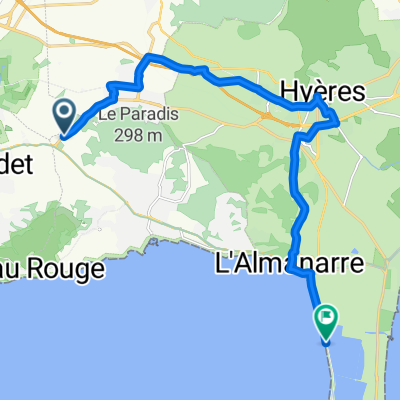
Route de la Moutonne, Carqueiranne to Route du Sel, Hyères
A cycling route starting in Carqueiranne, Provence-Alpes-Côte d'Azur Region, France.
Overview
About this route
- 58 min
- Duration
- 17 km
- Distance
- 112 m
- Ascent
- 144 m
- Descent
- 17.7 km/h
- Avg. speed
- 72 m
- Max. altitude

Route quality
Waytypes & surfaces along the route
Waytypes
Quiet road
4.1 km
(24 %)
Road
3.2 km
(19 %)
Surfaces
Paved
16.3 km
(96 %)
Asphalt
15.8 km
(93 %)
Concrete
0.3 km
(2 %)
Continue with Bikemap
Use, edit, or download this cycling route
You would like to ride Route de la Moutonne, Carqueiranne to Route du Sel, Hyères or customize it for your own trip? Here is what you can do with this Bikemap route:
Free features
- Save this route as favorite or in collections
- Copy & plan your own version of this route
- Sync your route with Garmin or Wahoo
Premium features
Free trial for 3 days, or one-time payment. More about Bikemap Premium.
- Navigate this route on iOS & Android
- Export a GPX / KML file of this route
- Create your custom printout (try it for free)
- Download this route for offline navigation
Discover more Premium features.
Get Bikemap PremiumFrom our community
Other popular routes starting in Carqueiranne
 Route de la Moutonne, Carqueiranne to Route du Sel, Hyères
- Distance
- 17 km
- Ascent
- 112 m
- Descent
- 144 m
- Location
- Carqueiranne, Provence-Alpes-Côte d'Azur Region, France
 TL 2011: 2. Etappe: Col de Bababou
- Distance
- 99.6 km
- Ascent
- 581 m
- Descent
- 581 m
- Location
- Carqueiranne, Provence-Alpes-Côte d'Azur Region, France
 Trip 2
- Distance
- 28.5 km
- Ascent
- 26 m
- Descent
- 26 m
- Location
- Carqueiranne, Provence-Alpes-Côte d'Azur Region, France
 2015_09_02 Tour in Südfrankreich
- Distance
- 128.6 km
- Ascent
- 1,552 m
- Descent
- 1,552 m
- Location
- Carqueiranne, Provence-Alpes-Côte d'Azur Region, France
 Recovered Route
- Distance
- 28 km
- Ascent
- 16 m
- Descent
- 215 m
- Location
- Carqueiranne, Provence-Alpes-Côte d'Azur Region, France
 Giens - La Londe - Pierrefeu - Cuers - La Crau - Hyères - Giens
- Distance
- 79.3 km
- Ascent
- 379 m
- Descent
- 379 m
- Location
- Carqueiranne, Provence-Alpes-Côte d'Azur Region, France
 1. Etappe zum Einrollen
- Distance
- 64.6 km
- Ascent
- 400 m
- Descent
- 403 m
- Location
- Carqueiranne, Provence-Alpes-Côte d'Azur Region, France
 YLP6
YLP6- Distance
- 39.1 km
- Ascent
- 672 m
- Descent
- 671 m
- Location
- Carqueiranne, Provence-Alpes-Côte d'Azur Region, France
Open it in the app