
Breitenauersee
- 50 km
- 1,654 m
- 1,668 m
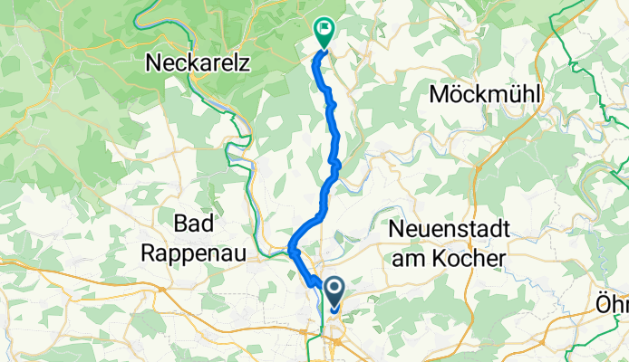
- Neckarsulm, Baden-Wurttemberg, Germany
A cycling route starting in Neckarsulm, Baden-Wurttemberg, Germany.
Overview
Embark on an exhilarating 22.8 km cycling adventure through scenic landscapes and varied terrain.
Feel the thrill as you ascend 261 meters, with a gentle descent of 145 meters along the way. The route peaks at a maximum elevation of 314 meters, offering breathtaking views and a true test of your cycling prowess.
Enjoy the mix of paved and unpaved surfaces, providing a dynamic challenge for cyclists of all levels.
Whether you're a seasoned cyclist or exploring new trails, this route promises a rewarding experience.
AI generated
created this 7 months ago
Route quality
Track
8 km
35 %
Quiet road
7.1 km
31 %
Paved
19.8 km
(87 %)
Unpaved
0.7 km
(3 %)
Asphalt
18.5 km
81 %
Concrete
0.9 km
4 %
Continue with Bikemap
You would like to ride NSU-Straße, Neckarsulm nach An der Steige, Billigheim or customize it for your own trip? Here is what you can do with this Bikemap route:
Free trial for 3 days, or one-time payment. More about Bikemap Premium.
Discover more Premium features.
Get Bikemap PremiumFrom our community
Open it in the app