
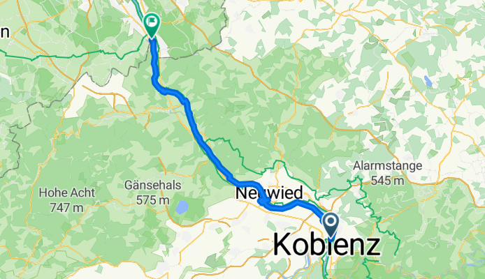
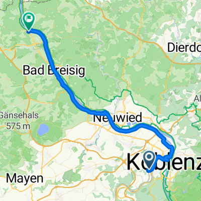
Rhein - Tag 4 - Koblenz nach Im Frankenkeller, Bonn
A cycling route starting in Koblenz, Rhineland-Palatinate, Germany.
Overview
About this route
- 3 h 32 min
- Duration
- 57.1 km
- Distance
- 285 m
- Ascent
- 295 m
- Descent
- 16.2 km/h
- Avg. speed
- 87 m
- Max. altitude
Route quality
Waytypes & surfaces along the route
Waytypes
Path
28 km
(49 %)
Quiet road
17.1 km
(30 %)
Surfaces
Paved
42.2 km
(74 %)
Asphalt
41.1 km
(72 %)
Paved (undefined)
0.6 km
(1 %)
Continue with Bikemap
Use, edit, or download this cycling route
You would like to ride Rhein - Tag 4 - Koblenz nach Im Frankenkeller, Bonn or customize it for your own trip? Here is what you can do with this Bikemap route:
Free features
- Save this route as favorite or in collections
- Copy & plan your own version of this route
- Sync your route with Garmin or Wahoo
Premium features
Free trial for 3 days, or one-time payment. More about Bikemap Premium.
- Navigate this route on iOS & Android
- Export a GPX / KML file of this route
- Create your custom printout (try it for free)
- Download this route for offline navigation
Discover more Premium features.
Get Bikemap PremiumFrom our community
Other popular routes starting in Koblenz
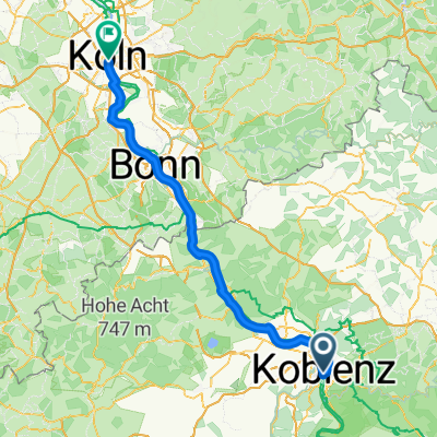 Koblenz - Köln
- Distance
- 100.4 km
- Ascent
- 503 m
- Descent
- 530 m
- Location
- Koblenz, Rhineland-Palatinate, Germany
 KO-Oberwerth-Loreley
- Distance
- 68.2 km
- Ascent
- 345 m
- Descent
- 341 m
- Location
- Koblenz, Rhineland-Palatinate, Germany
 Mosel / Nahe Tour
- Distance
- 532.1 km
- Ascent
- 6,856 m
- Descent
- 6,850 m
- Location
- Koblenz, Rhineland-Palatinate, Germany
 Von Koblenz bis Remagen
- Distance
- 51.2 km
- Ascent
- 272 m
- Descent
- 276 m
- Location
- Koblenz, Rhineland-Palatinate, Germany
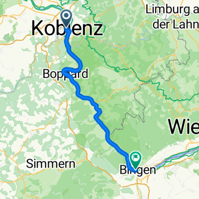 005Koblenz - Bingen am Rhein
- Distance
- 64.9 km
- Ascent
- 700 m
- Descent
- 699 m
- Location
- Koblenz, Rhineland-Palatinate, Germany
- Von Mayen (Osteifel) nach Koblenz (Rhein)
- Distance
- 54.9 km
- Ascent
- 421 m
- Descent
- 223 m
- Location
- Koblenz, Rhineland-Palatinate, Germany
 Rhein - Tag 4 - Koblenz nach Im Frankenkeller, Bonn
- Distance
- 57.1 km
- Ascent
- 285 m
- Descent
- 295 m
- Location
- Koblenz, Rhineland-Palatinate, Germany
 Sankt Sebastian - Bonn
- Distance
- 50 km
- Ascent
- 628 m
- Descent
- 615 m
- Location
- Koblenz, Rhineland-Palatinate, Germany

Open it in the app