
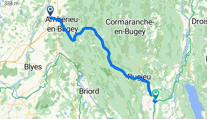
Château Gaillard to Belley
A cycling route starting in Château-Gaillard, Auvergne-Rhône-Alpes, France.
Overview
About this route
Despite D1504 being a major arterial, there was pretty good road shoulder virtually the entire ride. As a result, we can recommend this route. We rode this in late September when there's relatively little tourist traffic, so traffic was pretty sparse. Needless to say, there's some nice scenery along this road.
Overall a pretty easy ride with no steep climbes...except for the last few hundred meters climbing to our gîte.
- 23 h 9 min
- Duration
- 55 km
- Distance
- 496 m
- Ascent
- 487 m
- Descent
- 2.4 km/h
- Avg. speed
- 383 m
- Max. altitude

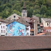
Route photos


Route quality
Waytypes & surfaces along the route
Waytypes
Cycleway
3.8 km
(7 %)
Road
3.3 km
(6 %)
Surfaces
Paved
46.2 km
(84 %)
Asphalt
46.2 km
(84 %)
Undefined
8.8 km
(16 %)
Continue with Bikemap
Use, edit, or download this cycling route
You would like to ride Château Gaillard to Belley or customize it for your own trip? Here is what you can do with this Bikemap route:
Free features
- Save this route as favorite or in collections
- Copy & plan your own version of this route
- Sync your route with Garmin or Wahoo
Premium features
Free trial for 3 days, or one-time payment. More about Bikemap Premium.
- Navigate this route on iOS & Android
- Export a GPX / KML file of this route
- Create your custom printout (try it for free)
- Download this route for offline navigation
Discover more Premium features.
Get Bikemap PremiumFrom our community
Other popular routes starting in Château-Gaillard
 Château Gaillard to Belley
- Distance
- 55 km
- Ascent
- 496 m
- Descent
- 487 m
- Location
- Château-Gaillard, Auvergne-Rhône-Alpes, France
 De 13 Rue de la Croix, Château-Gaillard à 2 Rue de l'Égalité, Meximieux
- Distance
- 15.5 km
- Ascent
- 948 m
- Descent
- 937 m
- Location
- Château-Gaillard, Auvergne-Rhône-Alpes, France
Open it in the app