
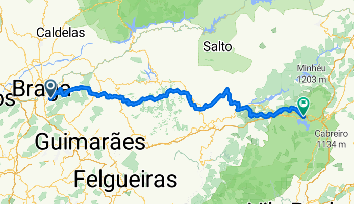
Overview
About this route
- 6 h 36 min
- Duration
- 96.9 km
- Distance
- 3,554 m
- Ascent
- 2,851 m
- Descent
- 14.7 km/h
- Avg. speed
- 995 m
- Max. altitude
Part of
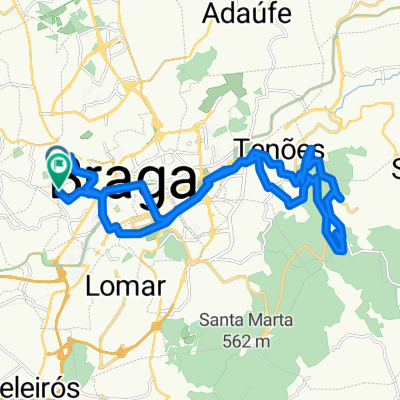
Route in Braga
7 stages
Route quality
Waytypes & surfaces along the route
Waytypes
Quiet road
65.9 km
(68 %)
Track
13.6 km
(14 %)
Surfaces
Paved
37.8 km
(39 %)
Unpaved
2.9 km
(3 %)
Asphalt
37.8 km
(39 %)
Ground
1.9 km
(2 %)
Continue with Bikemap
Use, edit, or download this cycling route
You would like to ride Braga - Ribeira de Pena or customize it for your own trip? Here is what you can do with this Bikemap route:
Free features
- Save this route as favorite or in collections
- Copy & plan your own version of this route
- Split it into stages to create a multi-day tour
- Sync your route with Garmin or Wahoo
Premium features
Free trial for 3 days, or one-time payment. More about Bikemap Premium.
- Navigate this route on iOS & Android
- Export a GPX / KML file of this route
- Create your custom printout (try it for free)
- Download this route for offline navigation
Discover more Premium features.
Get Bikemap PremiumFrom our community
Other popular routes starting in Braga
 Rua Pe António da Anunciação, Braga a Rua Pe António da Anunciação, Braga
- Distance
- 26.1 km
- Ascent
- 598 m
- Descent
- 599 m
- Location
- Braga, Braga District, Portugal
 BRAGA VIGO
- Distance
- 106.6 km
- Ascent
- 1,103 m
- Descent
- 1,253 m
- Location
- Braga, Braga District, Portugal
 PL-Forn-Guim
- Distance
- 76.9 km
- Ascent
- 895 m
- Descent
- 892 m
- Location
- Braga, Braga District, Portugal
 Trail - BJ-SM
- Distance
- 12.7 km
- Ascent
- 440 m
- Descent
- 421 m
- Location
- Braga, Braga District, Portugal
![Teste Sousa [1:LineString]](https://media.bikemap.net/routes/17137519/staticmaps/in_c37de768-e55e-4b68-b97b-9bb847ce9201_400x400_bikemap-2021-3D-static.png) Teste Sousa [1:LineString]
Teste Sousa [1:LineString]- Distance
- 53.9 km
- Ascent
- 1,516 m
- Descent
- 1,501 m
- Location
- Braga, Braga District, Portugal
 Route in Braga
- Distance
- 2,091.4 km
- Ascent
- 35,169 m
- Descent
- 35,168 m
- Location
- Braga, Braga District, Portugal
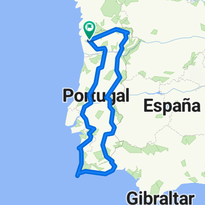
 Portugal dos bravos
- Distance
- 731.5 km
- Ascent
- 4,349 m
- Descent
- 4,472 m
- Location
- Braga, Braga District, Portugal
 Sameiro to Citania de Britanios
- Distance
- 7.9 km
- Ascent
- 150 m
- Descent
- 420 m
- Location
- Braga, Braga District, Portugal
Open it in the app