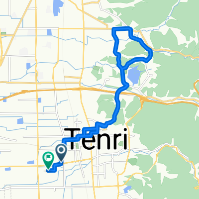
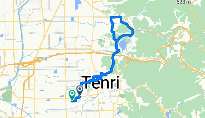
天理市 まで126−7
A cycling route starting in Tenri, Nara, Japan.
Overview
About this route
- 1 h 34 min
- Duration
- 15.3 km
- Distance
- 163 m
- Ascent
- 200 m
- Descent
- 9.8 km/h
- Avg. speed
- 146 m
- Max. altitude
Route quality
Waytypes & surfaces along the route
Waytypes
Road
8.7 km
(57 %)
Quiet road
3.8 km
(25 %)
Surfaces
Paved
8.9 km
(58 %)
Paved (undefined)
8.9 km
(58 %)
Undefined
6.4 km
(42 %)
Continue with Bikemap
Use, edit, or download this cycling route
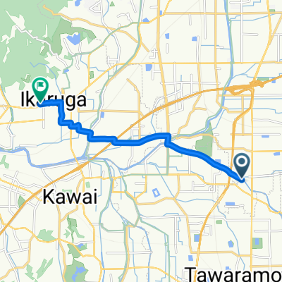
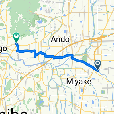
You would like to ride 天理市 まで126−7 or customize it for your own trip? Here is what you can do with this Bikemap route:
Free features
- Save this route as favorite or in collections
- Copy & plan your own version of this route
- Sync your route with Garmin or Wahoo
Premium features
Free trial for 3 days, or one-time payment. More about Bikemap Premium.
- Navigate this route on iOS & Android
- Export a GPX / KML file of this route
- Create your custom printout (try it for free)
- Download this route for offline navigation
Discover more Premium features.
Get Bikemap PremiumFrom our community
Other popular routes starting in Tenri
天理市 まで154−25- Distance
- 41.1 km
- Ascent
- 302 m
- Descent
- 342 m
- Location
- Tenri, Nara, Japan
天理市 まで126−7- Distance
- 15.3 km
- Ascent
- 163 m
- Descent
- 200 m
- Location
- Tenri, Nara, Japan
今国府町308-2, 大和郡山市 to 下永1064, 磯城郡川西町- Distance
- 5.2 km
- Ascent
- 6 m
- Descent
- 10 m
- Location
- Tenri, Nara, Japan
202510272- Distance
- 9.9 km
- Ascent
- 18 m
- Descent
- 67 m
- Location
- Tenri, Nara, Japan
204-1, Senzaicho, Tenri-Shi to 41-2, Yoshinoyama, Yoshino-Cho, Yoshino-Gun- Distance
- 34.1 km
- Ascent
- 710 m
- Descent
- 550 m
- Location
- Tenri, Nara, Japan
からのルート147−22- Distance
- 39.4 km
- Ascent
- 122 m
- Descent
- 201 m
- Location
- Tenri, Nara, Japan
126−11 まで126−7- Distance
- 13.8 km
- Ascent
- 166 m
- Descent
- 209 m
- Location
- Tenri, Nara, Japan
202510271- Distance
- 10.1 km
- Ascent
- 27 m
- Descent
- 70 m
- Location
- Tenri, Nara, Japan
Open it in the app

