
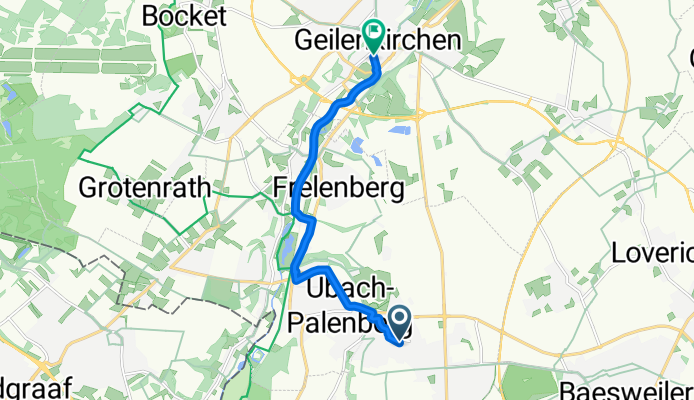
Thornstraße, Übach-Palenberg nach Herzog-Wilhelm-Straße, Geilenkirchen
A cycling route starting in Übach-Palenberg, North Rhine-Westphalia, Germany.
Overview
About this route
Get ready for an exhilarating cycling adventure! Begin your journey at Thornstraße 28 in Übach-Palenberg, where the asphalt path awaits. As you pedal, enjoy a mix of serene forest trails and quiet country roads, making up 54% of your ride.
Feel the thrill as you tackle some challenging descents—perfect for revving up those brakes! The ascent is gentle, adding just 10 meters to your journey. Keep your spirits high, as you'll be back at a lower elevation by the end.
The route winds through varied terrains, from paved roads to unpaved paths, with an average elevation of just 126 meters.
Arrive at your destination at AOK RheinlandHamburg - Die Gesundheitskasse Geschäftsstelle Geilenkirchen, Herzog-Wilhelm-Straße 26, ready for a well-deserved break!
AI generated
- 27 min
- Duration
- 7.9 km
- Distance
- 11 m
- Ascent
- 62 m
- Descent
- 17.9 km/h
- Avg. speed
- 127 m
- Max. altitude
Route quality
Waytypes & surfaces along the route
Waytypes
Track
3.1 km
(39 %)
Path
2.7 km
(34 %)
Surfaces
Paved
5.6 km
(71 %)
Asphalt
4 km
(50 %)
Paved (undefined)
1.7 km
(21 %)
Undefined
2.3 km
(29 %)
Continue with Bikemap
Use, edit, or download this cycling route
You would like to ride Thornstraße, Übach-Palenberg nach Herzog-Wilhelm-Straße, Geilenkirchen or customize it for your own trip? Here is what you can do with this Bikemap route:
Free features
- Save this route as favorite or in collections
- Copy & plan your own version of this route
- Sync your route with Garmin or Wahoo
Premium features
Free trial for 3 days, or one-time payment. More about Bikemap Premium.
- Navigate this route on iOS & Android
- Export a GPX / KML file of this route
- Create your custom printout (try it for free)
- Download this route for offline navigation
Discover more Premium features.
Get Bikemap PremiumFrom our community
Other popular routes starting in Übach-Palenberg
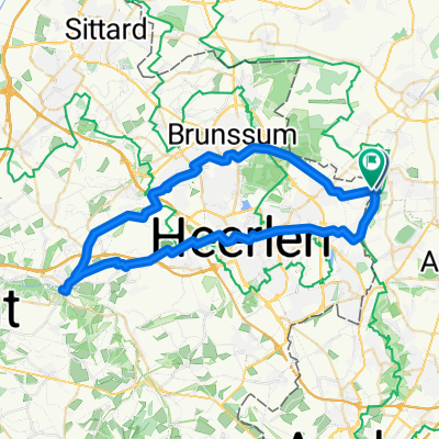
 Ostern-Hendrik-2023-Maastricht_A
- Distance
- 44.6 km
- Ascent
- 354 m
- Descent
- 386 m
- Location
- Übach-Palenberg, North Rhine-Westphalia, Germany
 In der Gehölde, Übach-Palenberg nach Schwarzer Weg, Linnich
- Distance
- 16.5 km
- Ascent
- 50 m
- Descent
- 98 m
- Location
- Übach-Palenberg, North Rhine-Westphalia, Germany
 Osterroute-Hendrik-2023-Maastricht_B
- Distance
- 40.5 km
- Ascent
- 310 m
- Descent
- 344 m
- Location
- Übach-Palenberg, North Rhine-Westphalia, Germany
 Thornstraße, Übach-Palenberg nach Herzog-Wilhelm-Straße, Geilenkirchen
- Distance
- 7.9 km
- Ascent
- 11 m
- Descent
- 62 m
- Location
- Übach-Palenberg, North Rhine-Westphalia, Germany
 2. Fahrradtour mit Tom
- Distance
- 21.8 km
- Ascent
- 173 m
- Descent
- 171 m
- Location
- Übach-Palenberg, North Rhine-Westphalia, Germany
 Übach-Palenberg nach Auf der Höhe, Übach-Palenberg
- Distance
- 0.9 km
- Ascent
- 0 m
- Descent
- 0 m
- Location
- Übach-Palenberg, North Rhine-Westphalia, Germany
 worm-heuvel route
- Distance
- 41.7 km
- Ascent
- 91 m
- Descent
- 92 m
- Location
- Übach-Palenberg, North Rhine-Westphalia, Germany
 Route in Landgraaf
- Distance
- 51.2 km
- Ascent
- 342 m
- Descent
- 343 m
- Location
- Übach-Palenberg, North Rhine-Westphalia, Germany
Open it in the app