
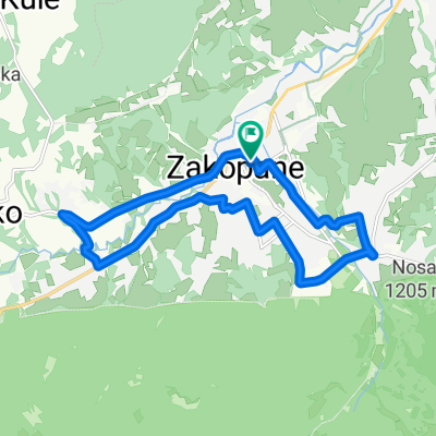
szlak 2
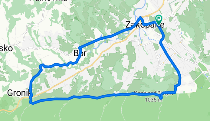
A cycling route starting in Zakopane, Lesser Poland Voivodeship, Poland.
Overview
About this route
- 1 h 9 min
- Duration
- 12.7 km
- Distance
- 366 m
- Ascent
- 406 m
- Descent
- 11.1 km/h
- Avg. speed
- 986 m
- Max. altitude

Route quality
Waytypes & surfaces along the route
Waytypes
Path
4.1 km
(32 %)
Pedestrian area
2.8 km
(22 %)
Surfaces
Paved
4.9 km
(39 %)
Unpaved
4.2 km
(33 %)
Asphalt
3.8 km
(30 %)
Gravel
3.3 km
(26 %)
Continue with Bikemap
Use, edit, or download this cycling route
You would like to ride szlak 2 or customize it for your own trip? Here is what you can do with this Bikemap route:
Free features
- Save this route as favorite or in collections
- Copy & plan your own version of this route
- Sync your route with Garmin or Wahoo
Premium features
Free trial for 3 days, or one-time payment. More about Bikemap Premium.
- Navigate this route on iOS & Android
- Export a GPX / KML file of this route
- Create your custom printout (try it for free)
- Download this route for offline navigation
Discover more Premium features.
Get Bikemap PremiumFrom our community
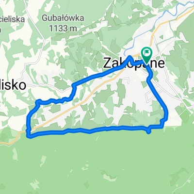
Other popular routes starting in Zakopane
 szlak 2
- Distance
- 12.7 km
- Ascent
- 366 m
- Descent
- 406 m
- Location
- Zakopane, Lesser Poland Voivodeship, Poland
 Day 2 Easier option
- Distance
- 15.5 km
- Ascent
- 661 m
- Descent
- 664 m
- Location
- Zakopane, Lesser Poland Voivodeship, Poland
 04.10.20 Jaskinia Mylna
- Distance
- 32.8 km
- Ascent
- 999 m
- Descent
- 946 m
- Location
- Zakopane, Lesser Poland Voivodeship, Poland
 VeloDunajec (z objazdami brakujących odcinków)
- Distance
- 82.8 km
- Ascent
- 889 m
- Descent
- 1,282 m
- Location
- Zakopane, Lesser Poland Voivodeship, Poland
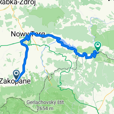
 Guty 3b, Zakopane do Trzech Koron 34a, Sromowce Niżne
- Distance
- 81.8 km
- Ascent
- 1,945 m
- Descent
- 2,262 m
- Location
- Zakopane, Lesser Poland Voivodeship, Poland
 Zakopane - Wierch Poroniec - Głodówka - Bukowina - Zakopane
- Distance
- 36.3 km
- Ascent
- 563 m
- Descent
- 563 m
- Location
- Zakopane, Lesser Poland Voivodeship, Poland
 Masa Krytyczna - Pierwsza na Podhalu!
- Distance
- 13.8 km
- Ascent
- 191 m
- Descent
- 191 m
- Location
- Zakopane, Lesser Poland Voivodeship, Poland
 D03v1ZaNoSa
- Distance
- 92.1 km
- Ascent
- 336 m
- Descent
- 900 m
- Location
- Zakopane, Lesser Poland Voivodeship, Poland
Open it in the app